


Author: Amy Whitesides

How One City is Designing for Climate Change
As the City of Boston grapples with climate change and sea level rise, teams comprised of Landscape Architects, Urban Planners, and Engineers have been collaborating to truly understand the scale of the impact, and propose innovative solutions that incorporate natural systems.
Recognizing the Challenges of Climate Change
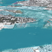
Coastal Resilience Solutions for East Boston and Charlestown, a project led by Kleinfelder Engineering and Stoss, was a direct response to recommendations in the Climate Ready Boston report (2016) that the city ‘prioritize and study the feasibility of district-scale flood protection’ and ‘develop local climate resilience plans in vulnerable areas to support district-scale climate adaptation’. The City of Boston chose to address East Boston and Charlestown first because they are currently at risk from the 1% annual chance coastal flooding and have high concentrations of vulnerable residents and critical infrastructure.
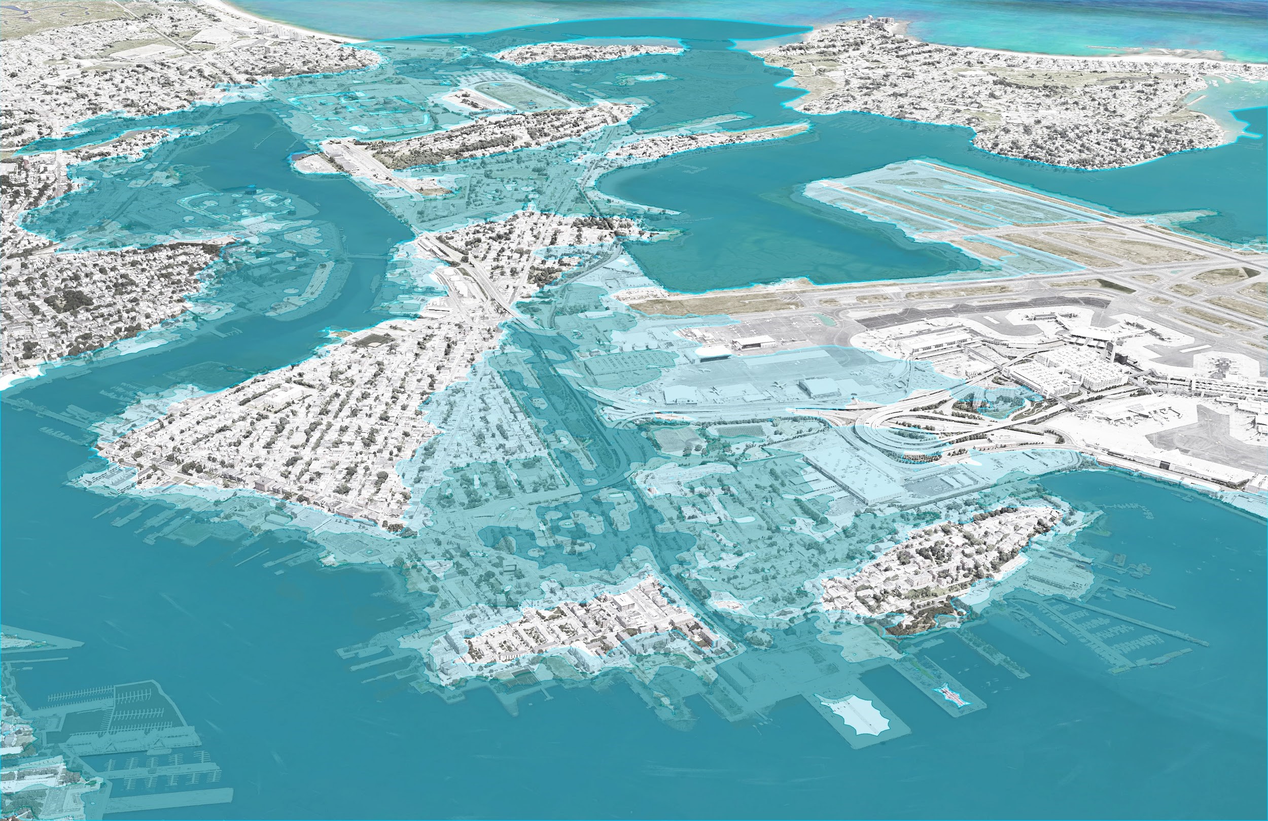
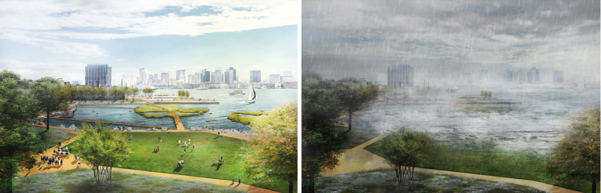
East Boston Flood Mapping
The design team, which included Kleinfelder, Stoss, One Architecture & Urbanism and Woods Hole Group, in coordination with partners at all levels of government, community members and the private sector, developed a resiliency strategy that included a set of evaluation criteria, recommendations for near-term and long-term actions, order-of-magnitude costs and an implementation roadmap to guide the city as it begins to move from planning to physical actions to protect the community.
Incorporating Meaningful Community Engagement
A robust and fun community engagement strategy was central to the development of the project vision and recommendations. Over 400 East Boston and Charlestown residents participated in meetings, open houses and surveys in which they shared their visions and priorities on coastal resilience solutions. Residents placed particular importance on ensuring access to the water and that solutions are effective over the long term.
Using Natural Systems to Improve Resilience
The resiliency strategy and design solution, currently featured as a model in the American Society of Landscape Architect’s Smart Policies for a Changing Climate exhibition, embraces layered flood control and integrated green infrastructure measures that mitigate the effect of climate change, and create social, environmental, and economic benefits and value to the people of East Boston and Charlestown and to all who share in the health of the city and the harbor.
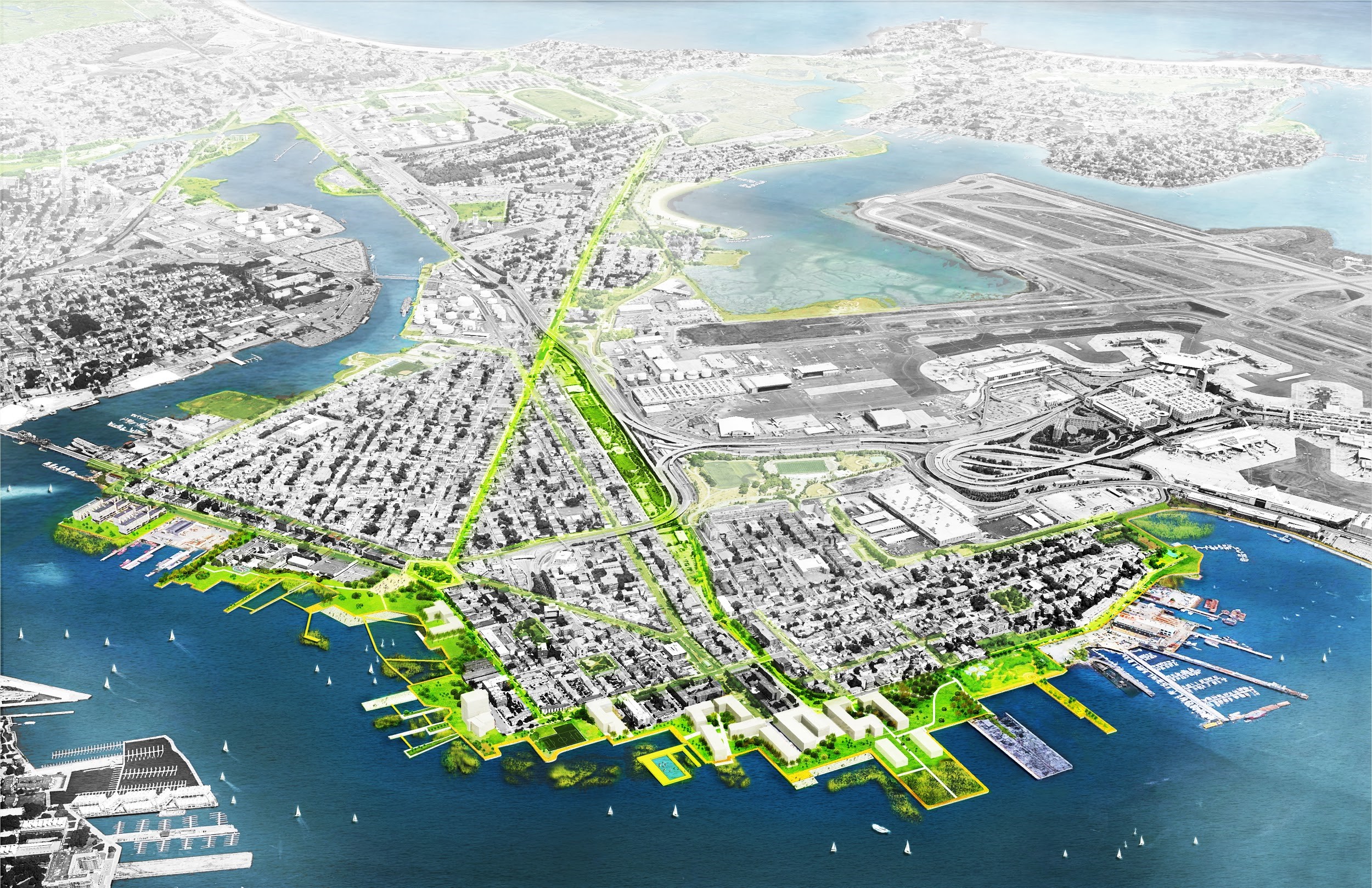
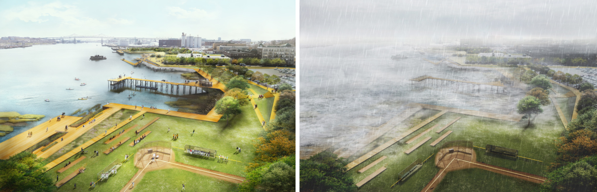
East Boston plan proposes green infrastructure including tiered hardscapes, natural wetlands and living shorelines as well as enhanced harborfront access.
These measures include waterfront open spaces with strategically elevated areas at key points of entry for coastal flooding such as the Greenway in East Boston and at Schrafft’s Center in Charlestown. Additional measures include; enhanced harborwalks with natural wetland buffers that include walkways that get people out and over the water in daily, dry, conditions; ‘living shorelines’ that can provide increased ecological benefits such as habitat; stepped hardscapes that combine social interaction with flood protection, creating places for just sitting and watching the activities; and increased planting of shade trees that help combat higher temperatures. Temporary flood barriers provide immediate protection while these systems are further planned and designed. All of these elements contribute to improved connections to the harborfront making it truly accessible for the broader community. Together, the measures will dramatically increase waterfront open space and public access to one of Boston’s greatest natural resources.
East Boston
Charlestown
The flood protection measures proposed are designed to be effective for 50+ years and would be raised to elevations sufficient to protect against the 1% annual chance flood level with 36 inches of sea level rise and a foot of storm surge, a condition currently estimated to be a potential reality in approximately 2070.
Encouraging Public Investment
Achieving the vision laid out by the project will require both direct public investments and private action guided by regulatory tools such as modified zoning and continued harborfront planning. The implementation plan developed by the project team outlines these actions as well as a number of exciting potential first steps to help catalyze future action. Together the measures outlined will provide flood protection, waterfront access, recreation, mobility and protect over 11,000 residents and at least 300 businesses as well as critical highway and transit infrastructure, healthcare facilities and other important services.
Boston is one of the few cities planning for sea level rise and climate impacts in advance of major storm-related damages. Coastal Resilience Solutions For East Boston and Charlestown was an important first step in this planning, setting the stage and developing a vision for additional future efforts to be undertaken by the city.
—
The Climate Ready East Boston project is one of 20 landscape architecture projects currently featured in the Smart Policies for a Changing Climate Exhibition sponsored by the American Society for Landscape Architects (ASLA). These projects highlight the ways in which landscape architects are building and enhancing communities that work in tandem with natural systems and considers the needs of all. To see the full exhibition, or submit a project worthy of recognition, visit the exhibition website at climate.asla.org.