Nemetschek’s Vectorworks Landmark is one of the few standalone BIM-enabling software packages targeted specifically towards landscape architects. In addition to the landscape-specific BIM capabilities that Vectorworks Landmark offers, it also incorporates mapping and GIS functionality as well as interoperability with a variety of building design applications such as Revit and ArchiCAD.
(SEE ALSO: Digitising Landscape Architecture: Revit for Landscape Architects)
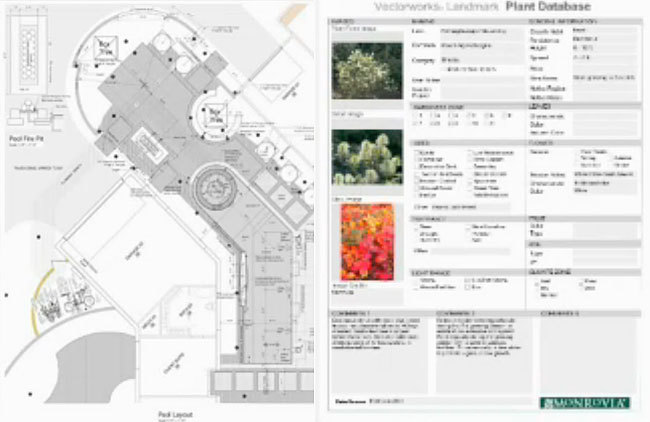
Vectorworks Landmark includes a substantial collection of built-in BIM-enabling intelligent tools such as terrain, plants (in a +8,000 plant database), hardscapes and retaining walls. For example, 2D tree symbols correspond to 3D tree ‘objects’ with all the information pertaining to that tree documented in a database for scheduling, procurement, costing, maintenance requirements and so on.
+8,000 plant database including photos for scheduling and report | Nemetschek Vectorworks
Interoperability is always an essential consideration, particularly when venturing away from the more traditional Autodesk-centric workflows. Vectorworks imports, exports and externally references AutoCAD dwgs (the new external reference capability in the 2014 release is a BIG plus), publishes drawing sets to PDF, imports concept models from SketchUp and exports 3d models to Google Earth. Another obvious consideration is cost. Vectorworks provides in a single program the workflow of AutoCAD, Land F/X and SketchUp.
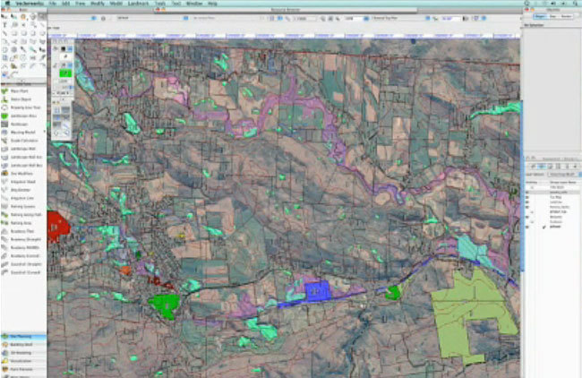
GIS functionality with importing shapefiles | Nemetschek Vectorworks
For a closer look at the software, I recently caught up with Eric Gilbey, Landscape Architecure Industry Specialist at Nemetschek Vectorworks.
Jason Packenham (JP) – What’s your 2 minute ‘elevator pitch’ to landscape architects looking to adopt a BIM workflow?
Eric Gilbey (EG) – When landscape architects look to adopt a BIM workflow, I would first want them to acknowledge whether they are doing so to model and document proposed changes and amenities for their own Site Information Modeling needs, or if they are doing so to collaborate with BIM clients. In either case, Vectorworks Landmark software can meet their needs. It is the only standalone application that offers integrated 2D/3D information modeling specific to landscape architecture and site design (Site Information Modeling). When collaborating with clients using other BIM applications, this occurs via IFC (data and geometry) and several 3D file formats (geometry only) that allow all design team participants to see and share files to then understand how the site works with the building and its infrastructure.
JP – Vectorworks’ BIM for Landscape Architects brochure details a substantial list of compatible applications, although engineering programs such as Civil 3D and 12D are notable exclusions. Vectorworks’ ability to allow collaboration with architects is well documented, but what capability does Vectorworks have with Civil 3D or 12D (or with LandXML files potentially provided by engineers) for those landscape architects who work closely with engineers on infrastructure projects?
EG – Collaboration with other applications, be they site-specific, 3D modeling, or general CAD, is straightforward when doing so with Vectorworks Landmark software. Civil3D and 12D, both exchange with DXF/DWG, which our software also treats as native geometry. We recommend that users communicate with their design team members about the file type and form of information being exchanged. Then, they can choose the best format to support those parameters. For example, several file format exchanges facilitate the import of site survey data into Vectorworks Landmark, including coordinate points listed in CSV or TXT files, data-rich DXF/DWG points, as well other 3D geometry such as mesh surfaces and 3D contours exported in various file formats. When creating or managing site information models in the software, it is always beneficial for the user to make use of any available 3D source geometry, but the workflows still exist for them to import and convert non-3D objects into a modeled site.
JP – What would you say to the experienced Autodesk-aligned landscape architects who are afraid to make the jump to Vectorworks? And to those users who have looked at Vectorworks in the past and decided against it? Have releases in recent years completed changed the game?
EG – I recently heard a user say, “I really enjoy using Vectorworks for site design. I don’t think I’ve ever heard someone say the same thing about an Autodesk product.” I feel the same way. In fact, before learning Vectorworks Landmark, I had been a long-time AutoCAD user and only designed by hand prior to that. However, once diving into the program, I discovered that Landmark’s site-specific tools were purpose-built for the work that we landscape architects do. It isn’t just a matter of figuring out a new way of laying out a site with lines, shapes, and text, and translating that into elevations or details, creating two or three times the work time involved just to get drawings out the door. Instead, the intuitive tools and hybrid nature of the site objects means less time getting drawings out and more time to move on to the next project. It also means that the objects I’m designing with, such as plants, hardscapes, turf areas, terrain models, etc., help me do a better job at site design because they are the same objects that report to the built-in worksheets, allowing me to analyze, quantify, and present, all within the same CAD application. In addition, Vectorworks had dedicated training and support teams that are available to help with your site-specific workflows.
JP – Vectorworks continues to include additional features and functions within future releases of the software. Are you able to shed any light on what works are in the pipeline for the future of Vectorworks Landmark?
EG – Every module of Vectorworks software sees development, which reacts to our users’ requests and industry trends. Our Landmark module’s future development is a great example of this as our focus will continue to be on developing solutions tailored specifically for landscape architecture and urban planning firms. While I can’t speak to any new features or enhancements specifically, future versions will continue to fundamentally focus on creating a finely tuned, easy-to-use product that continues to deliver best-in-class solutions for graphic representation, site information modeling, and integrated 2D/3D site design and modeling.
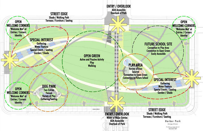
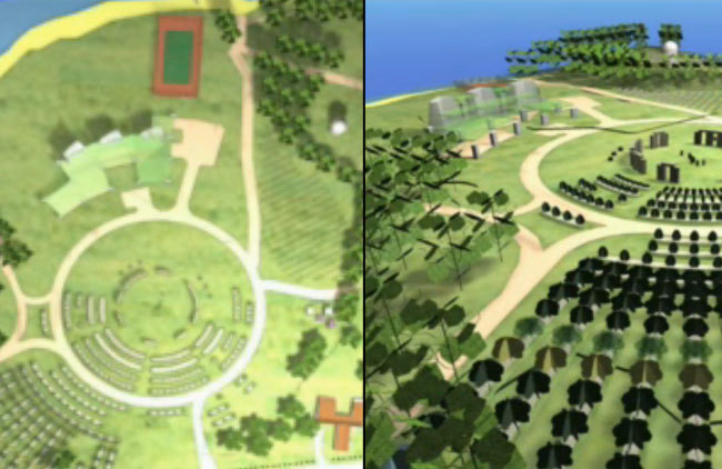
Concept graphics | Nemetschek Vectorworks
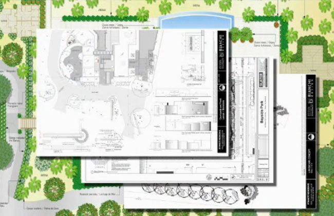
Batch plotting | Nemetschek Vectorworks
For those who are hesitant to venture away from the Autodesk environment they have been trained in and have operated within their entire careers, Vectorworks will require some time for adjusting, as would be expected. On this issue, there appear to be mixed reports from users both within the Land8 community and across other online forums.
2D drafting and 3D modelling occurs simultaneously | Nemetschek Vectorworks
But I must say, as someone who has previously used Vectorworks Landmark and is now using other CAD software (due mainly to a change in projects I’m involved in), the 2014 release of Vectorworks Landmark looks to have addressed many of my previous concerns with the program, not least of which is the ability to externally reference .dwg files without the need for importing into your drawing. This feature, along with many other new ones, looks promising, and I encourage even those who have previously shied away from Vectorworks to have a look at the 2014 release, and be sure to let us know how you go.
A big thank you to Eric Gilbey and the Vectorworks team for their time! This article is part of the Digitising Landscape Architecture series. Click here to view other articles in the series.
Jason Packenham is a Landscape Architect at Corkery Consulting and design studio tutor in the Bachelor of Landscape Architecture program at the University of New South Wales.
Published in Blog




Matthew Stubbs
Does Vectorworks Landmark have a irrigation design function? I tried looking for something on their website about it but there is no mention of it. I would think there would have to be one, since irrigation is such a important part of Landscape Architecture.
Jason Packenham
Good question Matt. It’s not a tool I have personal experience with, but Landmark does provide an irrigation tool palette that allows you to place irrigation lines, irrigation heads and drip emitters.
When placing one of these items, you can add information to its properties, such as manufacturer, model, spray type, head, nozzle and the list goes on. You can then add an irrigation schedule to your Plan which can include any of this information.