Landscape Architecture for Landscape Architects › Forums › SUSTAINABILITY & DESIGN › ArborPro GIS Tree Inventory Software
- This topic has 1 reply, 3 voices, and was last updated 12 years ago by
 Les Ballard.
-
AuthorPosts
-
October 7, 2011 at 6:06 pm #160092
 Judith MercadoParticipant
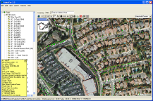
I currently work for ArborPro, which supplies a GIS software that GPS trees and georeference them on an aerial image. The software allows you to maintain tree characteristics such as common and botanical name, condition, height, spread, DBH, ect. The software also allows you to maintain record of maintenance work done on that tree. With that in mind the software also allows you customize reports such as species frequency and inventory reports.
Check out the link below and send me a message if you’re interested or have any further questions.
December 23, 2011 at 3:21 pm #160094 Les BallardParticipant
In reading your post some things occur to me and wonder if you would have any wish to respond here to the points below.
Local authorities in the UK seem to be led by the clubs they all belong to though they contract for tree and planting services as a rule. No doubt other countries have similar advisers. Since Victorian times there have been predominantly garden varieties of trees planted in the UK, not wild ones, in spite of the huge numbers and higher costs, all for the sake of maybe a more compact tree. That said, there has been the success story of the hybrid, sterile, London Plane tree which has been so important in filtering pollution in London, especially before the Clean Air Act stopped the smogs. There are also considerations over fruit nuisance or dangers from old folk slipping on berries, or maybe cars firing nuts, from trees dropping fruit on the roads, from under tyres like bullets. Contractors often remove logs from felled timber for their own profit not social benefit, e.g. every authority could grow the wood used in schools instead of importing it and make their own boards for shuttering, etc. as well as fencing. Contractors could be required to give significant profits back to the people. No money ever seems to be made from wood sale in any form, even logs or fake ones pressed from sawdust, to burn, though options are appreciated and in print anyway, aimed for. About 13 agencies have access to the streets via any number of contractors and any may have to trim or remove trees, tops or roots, at any time or many times a year as well as dig up the roads. Trees regularly die or are adversely affected by physical damage/attack or a lack of watering, perhaps through a lack of water permeable surfacing, over zealous pollarding or thinning – which could be deliberate in places – and the same parties work with education authorities to care for trees in school grounds. Some trees are found to affect sewers, pipes including mains, housing re subsidence and there are other factors while all and any have to be considered re the siting of new trees or replacements. Areas have specific fruit and other trees associated with them that are not planted any more and it is generally understood by experts that it is not a good idea to plant trees which will not thrive in a given soil type or will change the habitat by evergreen’s acidification of a better soil. Foreign species/varieties leading to hybridisation in quantity might also be limited. Does your system consider any of these problems and might they be mentioned to both the local authority clubs and other parties who may recommend use of the system and can the points then be conveyed to the prospective purchasers? Finally, does your programme consider latitude and altitude and plan to grow trees – as is possible – with other cover to protect from wind and cold while allowing, also, for global warming and the need to allow for that when considering what may thrive in just a decade’s time? All these points seem salient though the basic idea does seem a little better than current mapping, with Excel or similar programming to comprise a database of work done, etc., especially if kept on a password controlled cloud system as well as the authority database just in case of failure if only through some calamity. As with Google maps mixing satellite and map images, it may be possible to project your information onto local plans of sewers, cables, mains, etc. to assist. I can see parties in landslide and earthquake prone areas being able to instantly update records from updated satellite photos though some programme will have to allot previous tree positions to new ones and, of course, see what trees no longer exist. No doubt it would do this in the same way radar allots identification tags to targets whether or not they have their own transponder and I can see old/rare/protected or sample trees fitted with such, at least, might be spectroscopically and infra-red policed to warn of premature fading, etc. when they seem ill or dry. Disease experts might be fascinated by this and pay to access adjoining client areas since, of course, diseases/pests know no such political restraints.
March 29, 2012 at 11:04 am #160093 Laith WarkParticipant
Is this software a commercial produce for sale? I checked the website but could not find a link to purchasing information. Thanks in advance for your reply.
-
AuthorPosts
- You must be logged in to reply to this topic.


