Autodesk InfraWorks is a relatively new program that provides an extremely powerful yet relatively simple 3D visualisation environment for importing and rendering extremely large datasets in real time.
Previously known as Autodesk Infrastructure Modeler, its rebranding perhaps suggests Autodesk’s recognition of the ability of this software to play a much larger role in the architecture, engineering and construction (AEC) industry.
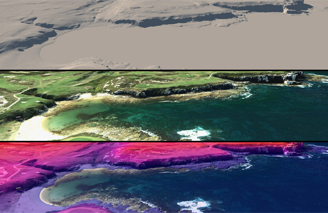
Large datasets are rendered in real time for presentation and analysis | Corkery Consulting
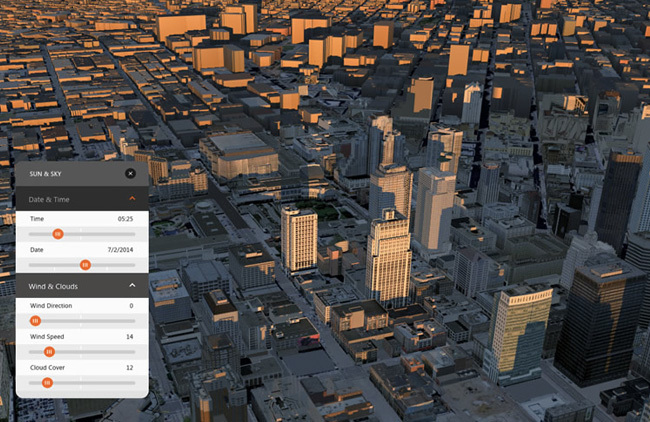
Beginning with the data of existing site conditions, InfraWorks provides a live-rendered virtual environment for importing complex topographic data, high resolution aerial photography, GIS shapefiles, CAD drawings as well as a number of other data types, for synthesising existing site conditions for discussion with clients and project teams. Analysis such as elevation, slope, aspect and shadows can not only be produced in a matter of seconds but also viewed in real time in 3D.
Shadow analysis | Autodesk
Alternative concepts for path and plaza locations, road alignments, areas of mass planting and building massing can be quickly explored via InfraWorks’ built-in modelling tools. Additionally, landscape architects can present and analyse their designs within InfraWorks with the surrounding terrain features, transportation networks, and buildings fully modelled at the block, neighbourhood, city, or regional level.
By sharing a model via InfraWorks 360, models can be viewed in any internet browser, even on computers that do not have InfraWorks installed. This allows landscape architects to share models with clients, stakeholders and collaborating professionals for review. The graphic quality of the online model environment doesn’t quite offer the same high quality rendering, but is still a reasonable tool for quickly sharing your conceptual explorations with clients (who appreciate being involved in the process!).
RELATED STORY: Civil 3D for Landscape Architects
Still renderings can be exported to image files, or the whole model can be exported to LandXML for importing into other modelling programs such as Civil 3D. This allows the conceptual models explored within InfraWorks to be incorporated as the first step in the detailed design phase within other applications. Animated visualisations can also be exported from InfraWorks to video files, although the Storyboard palette required to do so is a little cumbersome.
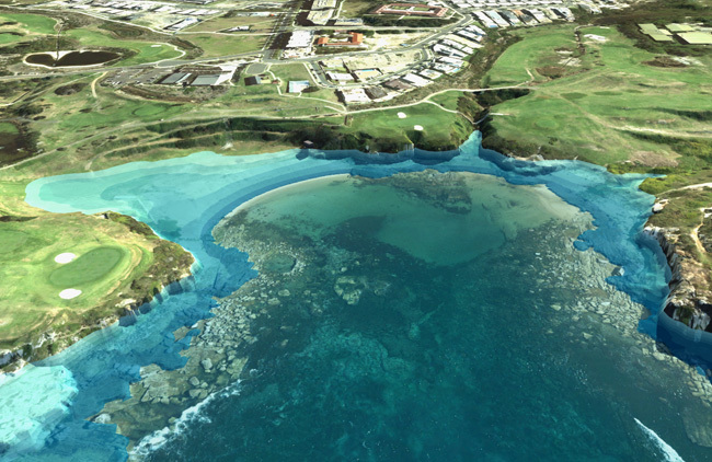
Analysing sea-level rise using InfraWorks | Corkery Consulting
I’ve always believed landscape architects are great synthesisers of information, able to view the bigger picture when other professionals can become bogged down in their own profession-specific agendas. Not only can InfraWorks form an important part of the workflow of a landscape architect, it can also provide an opportunity for landscape architects to reposition themselves within project teams, acting as synthesisers of multiple disciplines to bring all elements of the project to realisation within a digital environment able to be rendered in real time. This facilitates easier communication between clients, stakeholders, consultants and members of the community.
Even if you feel as though some of the features explained above don’t really relate to your current workflow, I’d definitely keep an eye on the development of this program over the coming years. Autodesk seems to have recognised the ability of InfraWorks to play a large role in the AEC industry, so future releases should continue to include more features related to the work of landscape architects.
This article is part of the Digitising Landscape Architecture series. Click here to view other articles in the series.
Jason Packenham is a Landscape Architect at Corkery Consulting and design studio tutor in the Bachelor of Landscape Architecture program at the University of New South Wales.
Published in Blog


