With the increased prevalence of BIM in the architecture, engineering and construction (AEC) industry, there has been ongoing debate within the profession of landscape architecture regarding the need to adopt BIM workflows.
Debate on the suitability of BIM-enabling programs aside, it’s impossible to ignore the growing push towards adopting BIM technologies. The UK Government, for instance, has even instated the compulsory adoption of BIM technologies and processes to increase collaboration at all stages of the project. (BIM Open Project, 2014)
What is BIM?
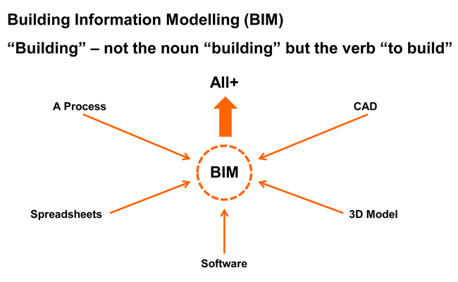
Depending on who you ask, the definition of BIM tends to differ. For example, in ASLA’s LATIS 2008 paper Integrating BIM Technology into Landscape Architecture (Sipes, 2008), BIM is discussed as a form of 3D modelling with intelligent data attached to the modelled ‘objects’; much of its discussion revolves around the process of modelling. On the other hand, the Landscape Institute has taken the position that BIM is more about the process of sharing information (Slavid, 2014).
The Landscape Institute also says the term ‘Building Information Modelling’ js complicated by the fact that the word ‘building’ is a verb, and so the acronym could be interpreted as ‘To Build an Information Model’, with the model potentially containing much more information than that related to a building. This information includes all data relating to design, costing, build-ability, clash detection, scheduling and procurement, sustainability impact, life cycle and facilities management factors (What is BIM?, 2014).
The Landscape Institute’s definition of BIM | Landscape Institute
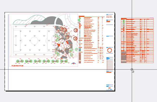
For the landscape architect, BIM can help transform a tree symbol in 2D CAD from a bundle of polylines and hatches into an intelligent tree ‘object.’ The smart tree object is now documented in a database for easy scheduling, procurement, costing, maintenance requirements and so on. Not only do we know it’s a tree, the tree “knows” it’s a tree and can offer up its height, width, whole-of-life performance information, sustainability impact, etc. without us inputing or knowing that information beforehand.
BIM intelligence provides data relating to the modelled objects | Land F/X
Most importantly though, BIM offers an integrated process built on coordinating and streamlining information about a project from design through construction and into operations and maintenance. Depending on your project needs, there are now several programs available that can help with collating these databases of information in association with BIM ‘objects’.
(Related Story: BIM in Landscape Architecture)
As a result, the integrated information in BIM can increase efficiency and even minimize user error in workflows. A parametric object can now store libraries of information and create easy access to up-to-date detailing, quantity take-offs, procurement, future maintenance requirements, etc. Once amendments are made across multiple drawings (plans, sections, models), the quantity and types of certain objects will also be automatically updated and eliminate the need to manually count and record the changes. When modeling the ‘smart’ tree, we are building information into the project model with the ultimate aim of creating coordinated, reliable information for all stages of a project’s life-cycle and facilitating true collaboration within the project team.
What does BIM mean for landscape architects?
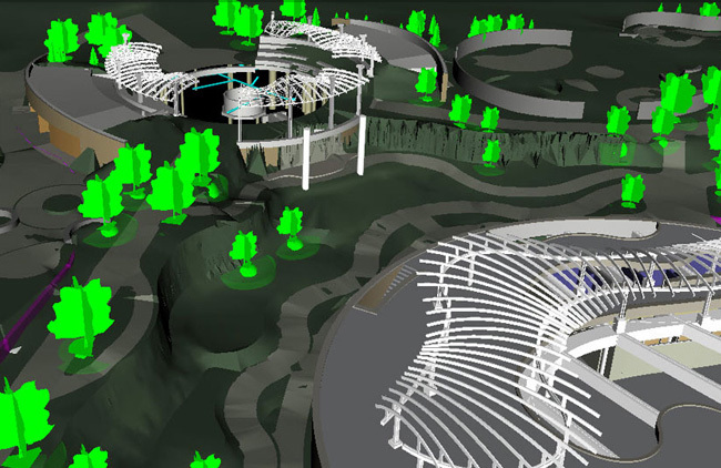
First and foremost, don’t rush into committing to a particular software package believing it will be the all-in-one answer you’ve been waiting for. Over the years, popular CAD programs have been tailored much more to the remainder of the AEC industry than to landscape architects. The current state of the BIM revolution would suggest this trend is likely to continue, at least with mainstream developers such as Autodesk and Bentley.
BIM Modelling | The Beck Group via Eagle Point
That doesn’t mean landscape architects won’t get a say, however. My advice is to stay tuned to those already engaged in the BIM revolution. The Landscape Institute is proactively involved in ensuring that the requirements of landscape architecture are considered as the UK’s AEC industry moves towards compulsory BIM project deliverables. They have a wealth of information available on their website. For anyone with the time, I would also recommend reviewing ASLA’s LATIS 2008 paper Integrating BIM Technology into Landscape Architecture.
Furthermore, stay tuned to the ‘big players’ in the BIM game – Autodesk, Nemetschek, Land F/X, Eagle Point, amongst some others. As already mentioned in the introductory article to this series, what landscape architects ‘do’ can vary so significantly that finding one particular program to suit all of our needs is highly unlikely, so engage with all your options. The BIM world is a business after all, and if landscape architects express their interest and need, business-savvy developers will be sure to fill the BIM gap.
To learn more about BIM in landscape architecture, stay tuned to the Digitising Landscape Architecture series, as we explore some of the more popular BIM-enabling programs used by landscape architects.
References
BIM Open Project. (2014). Retrieved March 31st, 2014, from Landscape Institute: http://www.landscapeinstitute.org/knowledge/BIMOpenProject.php
Sipes, J. L. (2008). LATIS – Integrating BIM Technology into Landscape Architecture. Washington DC: American Society of Landscape Architects.
Slavid, R. (2014). BIM for Landscape. Landscape.
What is BIM? (2014). Retrieved March 31st, 2014, from Landscape Institute: http://www.landscapeinstitute.org/knowledge/WhatisBIM.php
This article is part of the Digitising Landscape Architecture series. Click here to view other articles in the series.
Jason Packenham is a Landscape Architect at Corkery Consulting and design studio tutor in the Bachelor of Landscape Architecture program at the University of New South Wales.
Published in Blog


