I was recently given the opportunity to test out the new Leica Disto D810 Touch – a hand held laser distance metre complete with a touch screen and on-board digital camera. Although I have previous experience with the older Leica Disto A5, it it was a good to get my hands on the new model.
Before I reflect on my own experience with the product and comment on its performance and design, let’s kick things off with a brief description of its features:
- As with most other laser metres, the Disto D810 Touch allows for the take-off of straight-line measurements and can generate a number of indirect calculations such as area, volume and hypotenuse.
- The device is able to measure up to a distance of 660’ with accuracy of 1/16”, suitable for pretty much any landscape architect’s requirements.
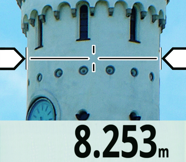
- It also features an on-board camera that allows you to take a photo of an object and measure its dimensions using the touch screen on the device itself. This point and shoot functionality calculates the depth of field in an image and enables real world measurements to be taken from the photos you snap.
Measurements on the photo using the devices touch screen | Leica Geosystems
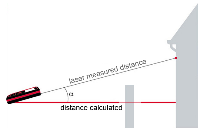
The device’s inclination tracking, Smart Horizontal, ensures the accuracy of indirect calculations and photo measuring. It also allows you to measure the distance of an object even when the perpendicular line of sight is obscured.
Horizontal distance measurement using Smart Horizontal TM
The touch screen is a world first for laser distance metres, and although it’s not quite as quick to navigate through as on a smartphone, it makes menu navigation much easier to use than on previous models.
Leica has also developed the Disto Sketch smartphone app, which allows dimensions to be quickly and wirelessly added to photos, sketches and excel spreadsheets. This allows for quick and accurate on-site takeoffs.
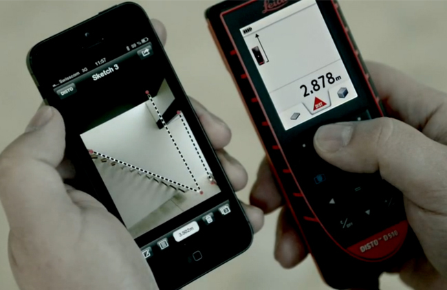 Disto Sketch smartphone app for adding measurements to photos, sketches and excel spreadsheets | Leica Geosystems
Most of my professional work takes place in the public arena and as such I am often provided with site survey drawings, but I can definitely imagine that landscape architects involved in residential work could save plenty of time using the Disto D810 Touch.
That being said, I took to the backyard in a ‘faux project’, looking to replicate what a landscape architect may do at the beginning of a residential engagement. I found that I was able to quickly and easily produce a dimensioned sketch plan for my yard using the Disto Sketch smartphone app.
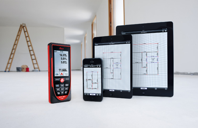 Disto Sketch provides a sketch plan tool for dimensioning your site | Leica Geosystems
One more neat trick I found with the new product was its ‘minimum/maximum mode’, which produces a smart little workaround for human error in the measuring process. All you do is run the laser in an arc shape through your furthest point of measure and it will detect that furthest point and record it as the measurement. I found this useful when measuring irregular corners of my site.
Now, I can imagine some people might be put off by the $849 USD price tag, but if you often find yourself taking on-site measurements then a workflow that combines the Disto D810 Touch with the Disto Sketch smartphone app could save you an hour or two each project. Furthermore, particularly in the case of a D&C firm, the on-site team could measure particular site areas/elements and wirelessly transfer these to the office-based design team, potentially removing the need for additional site visits later in the project. When you consider the cumulative effect of this saving, maybe the price tag is a little easier to digest?
All-in-all, considering the vast improvement on the older model that we’ve got in our office and Leica’s effort to move to a more streamlined digital process, it was a positive experience with the new Leica Disto D810 Touch.
Jason Packenham is a Registered Landscape Architect at Context and design studio tutor in the Bachelor of Landscape Architecture program at the University of New South Wales.
Published in Blog



![Equity, Justice, and Landscape [Webinar]](https://land8.com/wp-content/uploads/2020/06/HKOJ2017_kb-224x150.jpg)



Laurent Paméla
Jason – interesting gadget… Thanks for sharing
Bob Cleaver
Jason, thank you for the review, can you update this review and your experiences with the leica? we would use this for field measuring both horizontal and vertical measurements, particularly the vertical capabilities, do you have a referral to a you tube or other info for site measuring as the leica site provides minimal assistance, thank you,
Benjamin George
Did you proof it against some known measurement when measuring height? I’m curious how accurate it is, or how finicky it is to get good accuracy.