


Author: Land8: Landscape Architects Network


Sketchy Saturday |031
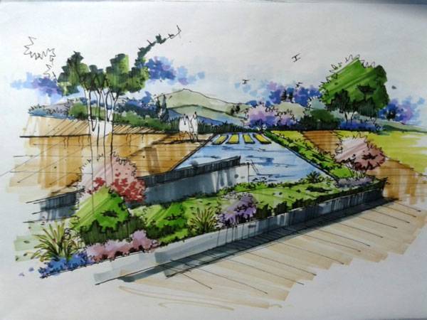
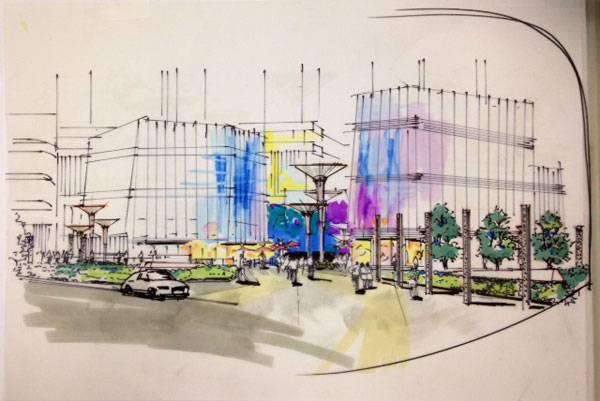
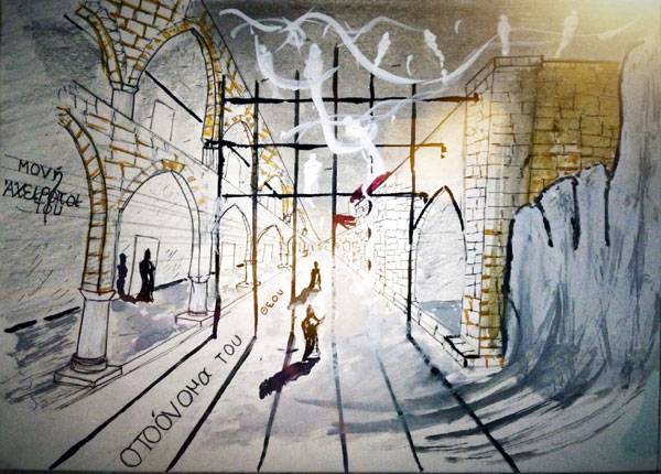
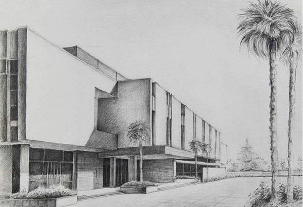
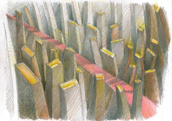
This week’s Sketchy Saturday top 10. Welcome to this week’s exciting edition of Sketchy Saturday; this week’s sketches show a great diversity in style with some Sketchy Saturday regulars throwing their hat into the ring for another attempt at top spot. Certainly sketching and free style hand techniques are skills that will always be appreciated, regardless of whether you are a student or professional so let yourself be inspired by this week’s top 10 and submit your own sketch for next week’s edition of Sketchy Saturday. 10. by Yingying Tu, Chinese student of Landscape Architecture
By Yingying Tu

By Monika Magoń
By Sarayut Chanachai

By Steven James Page
By Partizan Arif Younus
By Juliana Lalaj
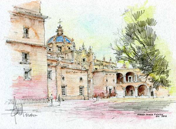
By Jesus Palafox Garcia
By Amaury Martins Neto
By Steven James Page
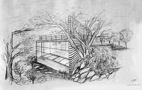
By Fred M Tabajonda
- Sketching from the Imagination: An Insight into Creative Drawing by 3DTotal
- Architectural Drawing Course by Mo Zell
Article written by Scott D. Renwick Return to Homepage


Stunning New Train Station Brings Landscape to Center of City
Vinge Station, by Henning Larsen Architects, Vinge, Denmark A visit to the future Vinge, Denmark, train station will likely evoke the imagination of Star Wars rather than the tradition of Hogwarts. The design by Henning Larsen Architects is futuristic, visionary, and beautiful. The Danish studio won an architectural competition to design the S-train station that will form the chief transportation hub in the center of Vinge, a 350-hectare city to be built in the Frederikssund region north of Copenhagen. The S-train is a network of regional trains in the Copenhagen area. A team from Henning Larsen Architects, in cooperation with Tredje Natur, MOE A/S and the Irish Railway Procurement Agency, designed the proposal, which a competition jury called both visionary and beautiful. While the station’s primary purpose is to connect Vinge to the regional public transit system, the undulating, circular hub is also designed to prevent the railway from dividing the town in two.
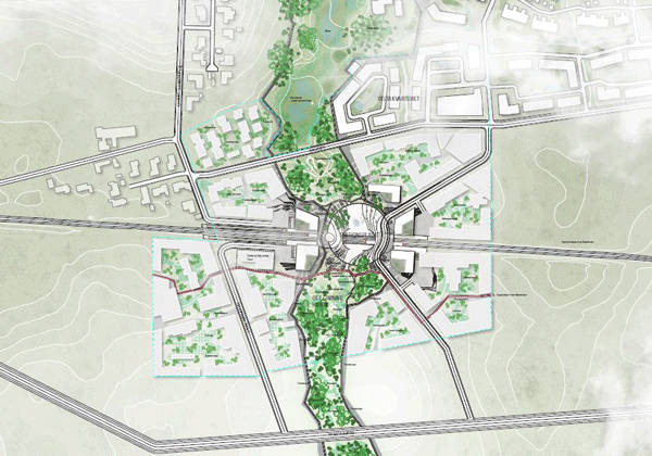
Photo Credit: Vinge S-Train Station by Henning Larsen Architects
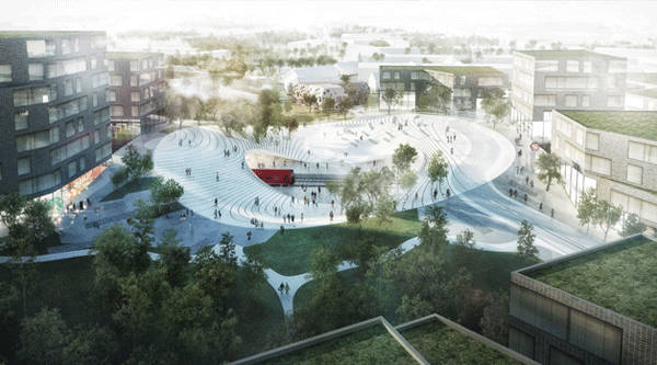
Photo Credit: Vinge S-Train Station by Henning Larsen Architects
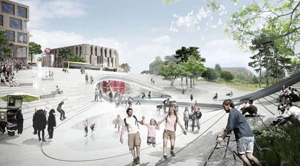
Photo Credit: Vinge S-Train Station by Henning Larsen Architects
Ameliorating Recreational Dimensions Through a New Train Station
“From the high-density environment of the city center, the architecture gradually transitions to lower, more open building typologies, scaling down the building stock towards the surrounding open landscape. The primary design goal has been to bring the surrounding scenery into the new city. Green areas within the urban context create breathing spaces, add a recreational dimension to the city — such as playing fields, urban parks, and wetlands — and ensure nature’s enduring presence in the city,” write Henning Larsen Architects. Related article:
- Copenhagen’s First Climate Resilient Neighbourhood
- Can Copenhagen Become the Best Cycling City in the World?
- Innovation in Water Management for Stunning Landscape Design
Formulation of an Integrated Town Space Henning Larsen Architects has also created the overall master plan for the town of Vinge. “We are very happy to be part of the first step of the development of Vinge by designing the train station and the urban space surrounding it. It is a symbolically strong beginning of a town development. Our idea is to create an integrated town space that connects the movements of the town and the landscape. In Vinge, the natural landscape becomes part of the town and you will be able to live in the countryside within the town,” explains Niels Edeltoft, architect and project manager at Henning Larsen Architects.
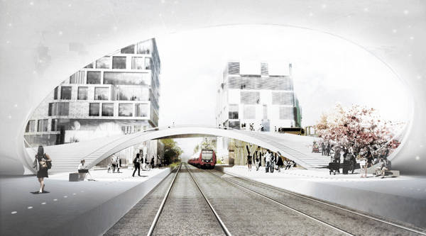
Photo Credit: Vinge S-Train Station by Henning Larsen Architects

Henning Larsen Architects is internationally recognized for its beautiful architectural works, including concert hall Harpa in Iceland, which won the prestigious Mies van der Rohe Award last year. The studio is also working on several projects in sustainable urban development. Henning Larsen Architects was founded by Henning Larsen in 1959, and over the years has designed many projects in Denmark and elsewhere in the world. The Vinge train station will be a hub for transportation and urban life once the city is fully developed, and the ultra modern look should fit in nicely within this city of the future. Recommended reading:
- Urban Design by Alex Krieger
- Digital Drawing for Landscape Architecture by Bradley Cantrell
Article by Sha Sulaiman Return to Homepage


A Totally New Space Saving Way of Growing Crops
Pyramid Garden, a new space saving way to grow crops. In a world of big box stores, convenience shops, and fast food chains, it is easy to lose sight of where our food comes from. Generations ago, families worked the fields and tended to gardens day and night to produce fresh vegetables and herbs for daily meals and canning or preserving for future seasons. Today the trend is again on the rise but we face new obstacles and challenges. In today’s fast-paced, on-the-go, high-energy world, few individuals have the time necessary for intensive vegetable gardening. While many desire to grow their own fresh produce, they often do not have the time or space required to do so.
The Limitations of Growing Crops in Containers
Container gardens have become one popular solution for those seeking to create a personal urban farm, but again there are limitations to container gardens. Some containers do not provide adequate space or drainage for vegetable plants and potted plants may still require weeding and fertilizing which can be time consuming. Even with pots of all shapes and sizes, those in a small city apartment may only have a few square feet to grow the desired variety of plants. The Pyramid Garden Solution The Pyramid Garden introduces an inventive solution to urban gardening for those who are lacking time and space. The planter is made of food grade polyethylene designed and coated to be UV resistant and long-lasting. Its design takes 4 identical panels with holes every 6 inches and arranges them in a pyramid form. WATCH: Pyramid Garden Greenhouse Tour This 4 foot by 4 foot configuration is ideal for sun and moisture requirements of plants and it allows for the highest possible density of plants in the least amount of space. In a 16 square foot area, a budding urban gardener can plant 136 plants. With so many spaces for plants, it allows for rotational crops, a large variety of plants, or planting in stages to increase the length of the harvest.

Image courtesy of www.pyramidgarden.com

Image courtesy of www.pyramidgarden.com

Image courtesy of www.pyramidgarden.com
- Landgrab City – Urban Farm
- Dublin Urban Farm: Interview with Paddy O’Kearney
- How to Provide Easy Access to Urban Agriculture in Over Populated Cities
800 plants, in just 32 square foot The Pyramid Garden has applications all across the board. There have been requests for 2 foot by 2 foot Pyramid Gardens for those in compact urban areas looking to grow food on balconies and patios. From the micro scale up to a macro scale, growers have even discussed verticalized vertical planters,’ which would involve placing the 4’x4’ Pyramid Gardens on pallet racks and stacking them at least three high.
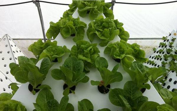
Romaine and Butter Head Lettuce. Image courtesy of www.pyramidgarden.com
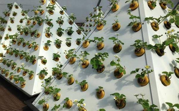
Strawberries Flowering. Image courtesy of www.pyramidgarden.com

Live lettuce harvested. Image courtesy of www.pyramidgarden.com

Basil and Red Butterhead. Image courtesy of www.pyramidgarden.com
- The Essential Urban Farmer by Novella Carpenter
- Mini Farming: Self-Sufficiency on 1/4 Acre by Brett L. Markham
Article written by Rachel Kruse Return to Homepage


Choosing Urban Trees: The Essential Guide
Key elements to consider when planning urban trees. We all know the importance of trees on the urban landscape. More than just decorative elements, they contribute to the city’s improvement in the social, cultural, economical, and of course, environmental levels. Due to the complexity of the city interaction, trees cannot simply be planted without any criteria – the relationship between the natural and the built environment can be tricky and some risks must be identified to be avoided. Here you have a guide to help you out. For a strategic planning of the urban forest, follow these 5 essential steps:
Choosing Urban Trees
1. Evaluate The City’s Needs A direct way of evaluating the city’s needs is to measure environmental conditions and variables as they will be of great importance to assist decision makers. However, cities belong to people and therefore they must also be involved in the decision making process. It is of great importance to allow the community to take part in the urban planning as residents know the local needs better than anyone else. WATCH: Urban Forestry 24: From Street Trees to Sustainability–Science, Practice, Tools 2. Get Informed on The Benefits As said before, urban trees improve the urban environment in many levels. To name just a few, beneficial social aspects include sense of belonging and opportunity for human interaction; cultural include collective identity, economical include property value uplift, energy saving and attractive high street retail. The environmental aspects list is a bit longer, worth going into more detail:
- Shading: this is a passive cooling strategy of major importance, especially in tropical countries, as it blocks direct solar radiation so it won’t reach people, buildings and surfaces.
- Reduced air temperature: trees reduce the air temperature through a process called ‘evapotranspiration’, as they take the heat from the air to transform water from liquid to gas form.
- Higher air humidity: another benefit of evapotranspiration is the increase in air humidity, as the process results in loss of water (vapour) by the plant.
- Induced wind flow: lined trees can induce the wind flow by either blocking it, slowing it down or speeding it up, depending on the local needs.
- Pollution filter: tree leaves can filter toxins in the air, improving its quality. Also, trees help reduce noise which is another sort of pollution.
WATCH: Why Trees? 3. Choose The Species Correctly We cannot provide a list of the most suitable trees for the urban environment as it varies from country to country. But here are some aspects you must pay attention to:
- Climate: Choose trees that are appropriate for the local climate, even better, choose native species.
- Soil: it is important to analyze the soil condition before planting, correcting it if necessary for healthy plants for a long time.
- Water: Respect the tree’s needs, if you cannot provide plenty of water choose species which tolerate drought.
- Toxicity: Make sure the trees you choose are safe for people, especially children.
- Fruits: An urban orchard is great but avoid trees with large fruits as they can cause accidents.
4. Respect The Existing Infrastructure Take a holistic approach when designing the urban forest. Respect the existing urban elements so both natural and built environment can safely co-exist:
- Take in consideration the tree’s typology; the canopy must not obstruct vehicle traffic and pedestrian walk ability; make sure the tree size matches the sidewalk and street width.
- Shallow roots may conflict with pavements or underground infrastructure, which may cause disruptions in service.
- Although there is a favorable presumption towards large canopy trees, they should not damage powerlines or buildings,
- And don’t forget to provide adequate distance between trees.
Related Articles:
- 8 Amazing Facts About Trees That You Didn’t Know
- Street Tree Survival Guide
- 8 Awesome Reasons to Use Trees in The Landscape That You Didn’t Know!
WATCH: Benefits of Urban Forests 5. The Importance of Maintenance If all the procedures of choosing and planting was done properly, the urban trees will demand little maintenance: about five visits in the first year and just two or three visits in the following ones. The maintenance program should include weeding, pest control, watering (if necessary) and pruning, as well as soil renewal and grid replacement (or any other sort of protection element). WATCH: Residential Street Tree Maintenance — In a financial cost-benefit analysis, the implementation of trees and green areas in the townscape is one of the best strategies to improve the quality of life of city dwellers. They are relatively low-cost and have a great positive effect on the urban environment – if done properly – hence, it should be widely encouraged by local organizations. For more specific information on urban forestry, please refer to your local guide (generally provided by your municipality or city council). Recommended Reading:
- Urban Trees: A Practical Management Guide by Steve Cox
- The Urban Tree Book: An Uncommon Field Guide for City and Town by Arthur Plotnik
Article written by Julia Lucchese Return to Homepage

Ground Breaking Masterplan Redefines The City of Bogotá
Bogotá Centro Administrativo Nacional (CAN), a new civic center in Colombia by OMA. Bogota, Colombia has retained a time-honored commitment to city planning and urban design. After Le Corbusier completed a master plan framework for the city from 1949-1953, a team was recently selected to redesign a master plan for a new downtown core. The program includes 680 acres of buildable area of which 72 acres is public open space. With a footprint as large as the National Mall in Washington, D.C., it is a large undertaking for designers to reimagine and redefine the city center of Bogota. They also have an opportunity to design on a national stage setting the precedent for other cities, as this is the largest institutional master plan in Latin American since the 1960’s.
Bogotá Centro Administrativo Nacional . Credit: OMA
The Context of the Masterplan
The context surrounding these 680 acres of new downtown area was vitally important in determining land use within the new city center. Planners, architects, and landscape architects considered the bounds, adjacent land use, and identified what was missing in the existing conditions. The new civic center for Bogota, Colombia is near the midpoint of a very important arterial street, Calle 26 Avenue, which operates as a strong axis in the city.
View from Calle 26. Credit: OMA
Mixed use at Bogotá Centro Administrativo Nacional . Credit: OMA
Government offices. Credit: OMA
View from Simon Bolivar Park. Credit: OMA
Aerial image of Bogotá Centro Administrativo Nacional . Credit: OMA
- Planting in Extreme Terrain and Harsh Climates
- Inspiring and Innovative Response to Urban Rooftop
- Top 10 Influential Landscape Architects
Retail corridor: Credit: OMA
The green spine. Credit: OMA
- Becoming an Urban Planner: A Guide to Careers in Planning and Urban Design by Michael Bayer
- Contemporary Urban Planning (10th Edition) by John M. Levy
Article written by Rachel Kruse. Return to Homepage

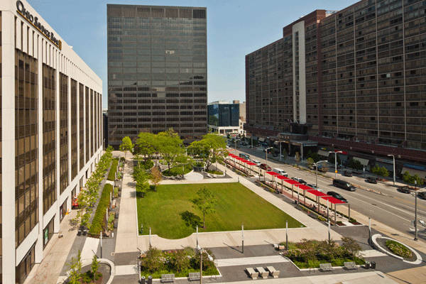
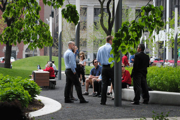
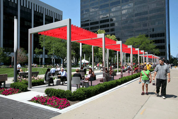
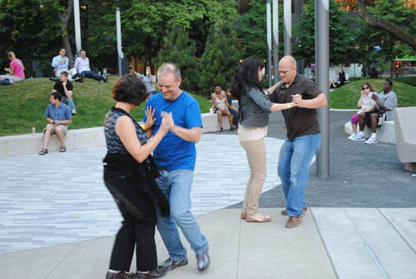
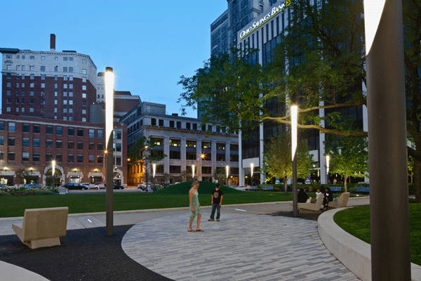
$3 Million Investment in Urban Park Breathes Life into Dying Downtown.
Perk Park by Thomas Balsley Associates, Cleveland, USA A vibrant, thriving downtown is key to the success of any major city, and evidence suggests that quality public spaces play a very important role in achieving a thriving downtown. Unfortunately, in many American cities, downtown cores are in decline. As a result, downtown public spaces are suffering, and many have become underused, neglected eyesores. However, there is good news. With the increasing recognition of the importance of healthy downtown communities, more cities than ever before are investing in rejuvenating their urban cores. Today, most major American cities are working to implement downtown revitalization or improvement schemes, which focus on the realization of community-based projects in their downtown areas.
Copyright, Scott Pease-Pease Photography 2012
Courtesy of Lisa DeJong
Copyright, Scott Pease-Pease Photography 2012
Courtesy of Lisa DeJong
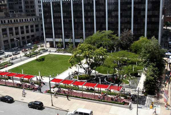
A Forest Meadow in an Urban Park
The design was inspired by what Thomas Balsley Associates describes as a “forest and meadow” concept. On the south side, a large, formal lawn area occupies the space where the sunken concrete plaza once sat, complete with planted mounds that reference the planter locations in the original design. The lawns gentle, playful slopes and mounds invite play, as well as providing great spaces to simply relax and enjoy the sun.
Courtesy of Downtown Cleveland Alliance
- Top 10 Reused Industrial Landscapes
- Community Turn Abandoned Industrial Site into Public Park
- Industrial Site Transforms into Beautiful Landscape
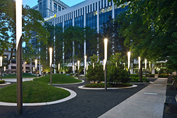
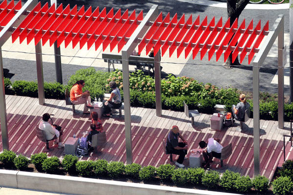
The North side of the site is shaded by a grove of honey locust trees (Gleditsia triacanthos), which provide dappled shade along with a more intimate and enclosed space. The grassy oval mounds in this area provide a sense of playfulness and visual interest. Brightly colored covered walkways on the East side of the site also provide further shade and seating, as well as blurring the boundaries between streetscape and park space. Considering the security issues with the park’s previous design, lighting was an especially important consideration to which Thomas Balsley Associates has paid tremendous attention to detail. The contemporary light fixtures implemented onsite greatly improve visibility and security in the park, making the space safe and comfortable for users day and night.
Courtesy of Lisa DeJong
Courtesy of Downtown Cleveland Alliance
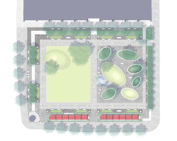
Photo credit: Perk Park, Cleveland, by Thomas Balsley Associates
Copyright Scott Pease-Pease Photography 2012
- The Contemporary Garden by Editors of Phaidon Press
- Gardens in Detail: 100 Contemporary Designs by Emma Reuss
Article written by Michelle Biggs Return to Homepage

How to Design a Relaxing Roller Coaster
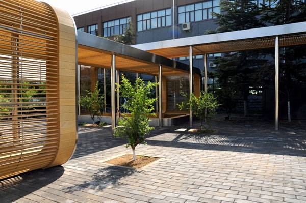
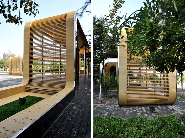
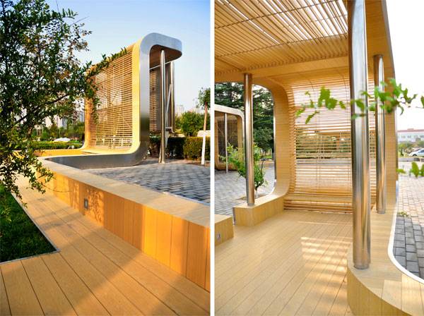
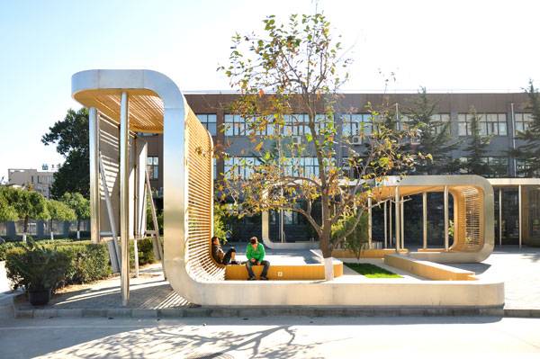
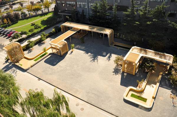
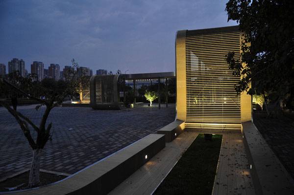
Roller Coaster by Interval Architects, Beijing, China. Take an empty little courtyard in front of a school, a place where nothing interesting happens, and dream of a curved, elegant structure that can create a place to play, sit, walk, and talk … maybe you are sitting on a little roller coaster! Situated in Beijing, China, the roller coaster project was designed by Interval Architects, an international design practice founded in 2010. What the Client Wanted and What The Client Got The client’s first idea was to put a monumental sculpture in the middle of the square to represent the school. But that idea was not functional or useful. So Interval Architects decided to transform this empty square by putting in a contemporary open structure — a wooden ribbon representing the image of an urban roller coaster. The project solves the problem of creating a communal gathering space, but is also sculptural, like the school initially intended.

Roller Coaster. Photo credit: GU Yunduan

Roller Coaster. Photo credit: GU Yunduan
A Flexible Design
There are four different areas, allowing students to sit one in front of the other and socialize between classes. At the same time, the urban space of the square remains flexible so that the seating area for students can also be used as an outdoor exhibition area.

Roller Coaster. Photo credit: GU Yunduan
- 30 Landscape Architecture Firms To Keep Your Eye On!
- Top 10 World Class Landscape Architecture Projects of 2013
- 10 Great Reasons to be a Landscape Architect
On the horizontal parts on the ground, some grass strips are planted. Inside and outside, little trees find the right sun exposure. The simple grass strips are designed in the center of the roller coaster to leave the lateral space for walking and sitting, providing a touch of minimalism.

Roller Coaster. Photo credit: GU Yunduan

Grass strip. Photo credit: GU Yunduan

Roller Coaster at night. Photo credit: GU Yunduan
- Landscape Architecture Now! by Philip Jodidio
- Detail in Contemporary Landscape Architecture by Virginia McLeod
Article written by Maura Caturano Return to Homepage

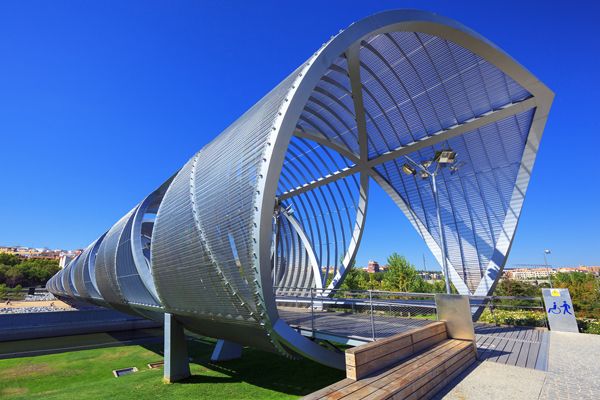
280 Million Euros Invested into Urban Revitalisation Project
Rio Madrid by West 8. There is something special about urban revitalization projects: they not only restore the physical environment but also confidence and hope on urban dwellers. Madrid Rio, with its generous green spaces, is a great example of a refreshing project that we, city inhabitants, are so in need of in a time of uncontrolled urbanization. What once was an intrusive motorway is today an amazing six-miles-long urban park that connects people and districts, showing us that it is possible to empower people through design.

Rio Madrid by West 8. © Municipality Madrid

Rio Madrid by West 8. © Municipality Madrid

Rio Madrid by West 8. © Municipality Madrid
The Main Features of the Urban Revitalisation Project
Among the several individual projects, the most important are: Salón de Pinos (2010) Making reference to the pine trees, as the name suggests, this green corridor connects the old and the new urban areas along the river, creating an inviting vegetated area.

Section through Salón de Pinos. ©West 8

Cascara Bridge. © Jeroen Musch

Cascara Bridge. © Jeroen Musch

Plataforma del Rey and Huerta de la Partida. © Municipality Madrid
- Turenscape Design Outstanding River Park
- Extraordinary Development Re-connects City With The River Bank
- Green Revival Brings Life Back to River Park

Avenida de Portugal by West 8. © Municipality Madrid

Arganzuela Park (left) and River garden at Toledo Bridge (right). © Municipality Madrid
Arganzuela Bridge in Madrid Rio Park, Madrid, Spain. Designed by Dominique Perrault, it is 274 meters in length and formed by two spiral-shaped walkways; credit: prochasson frederic / shutterstock.com
- Happy City: Transforming Our Lives Through Urban Design by Charles Montgomery
- Urban Street Design Guide by National Association of City Transportation Officials
Article written by Julia Lucchese Return to Homepage


Sketchy Saturday |030
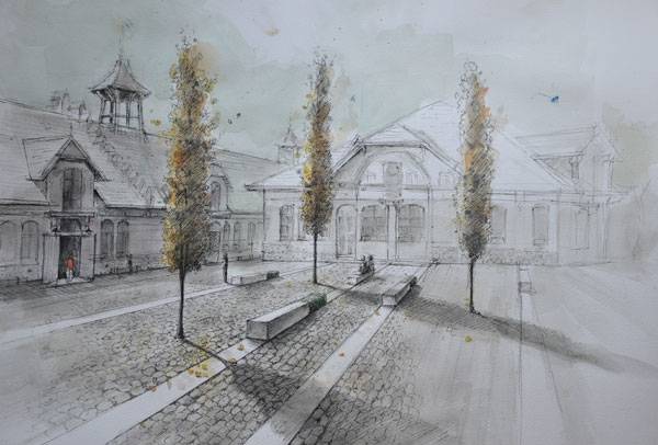
This week’s Sketchy Saturday top 10. Welcome to this week’s edition of Sketchy Saturday; this week’s sketches are breathtaking, with some Sketchy Saturday regulars dipping into their portfolio and wowing us with their talent as well as some first timers throwing their hat into the ring, bidding to be featured on our international and ever growing world stage. Sketchy Saturday is a melting pot of talent made up from contributions from around the globe, including professionals, students, and sketching enthusiasts; making the top 10 very tricky to judge. 10. by Nayeli Pérez Contreras from México, architecture student
By Nayeli Pérez

By Ketaki Godbole-Randiwe
By Daniel Dillenburg
By Beatriz de Pina Castiglione
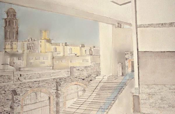
By Archit Singh
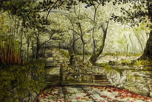
By André Diogo
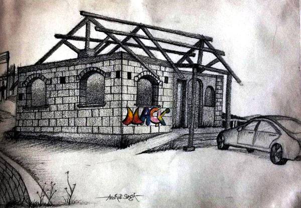
By Djordje Pralica
By Martyna Stapińska
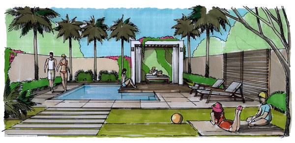
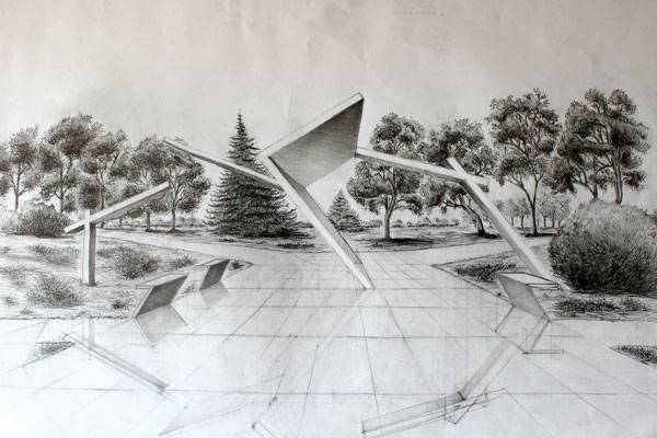
“I made this sketch because I wanted to show how landscape architecture can solve the problem of a modern gateway to a park and also show how my proposition will look like on a paper and not only in my imagination. I wanted to see how my idea fitted in the space of the park and whether it would be practical.” – The drawing was made on B2 paper, I used only pencil – 2b and 8b. 2. by Fred M Tabajonda, Landscape / irrigation designer in Bahrain since 1988, Philppines.

By Fred M Tabajonda
By Wiktor Kłyk
- Sketching from the Imagination: An Insight into Creative Drawing by 3DTotal
- Architectural Drawing Course by Mo Zell
Article written by Scott D. Renwick Return to Homepage


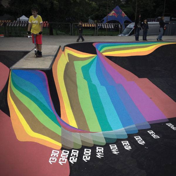
The Skate Park That Thinks it Can Tell The Time!
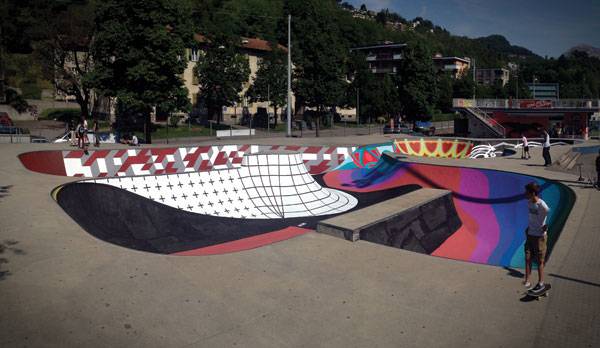
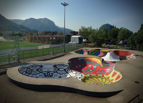
Swiss skate park, by Zuk Club. Zuk Club is a Moscow-based collective of artists working in mixed media who explore different artistic styles. Their interests have expanded and flowed into design, monumental, and contemporary art. They experiment through graffiti art and canvassing hard surfaces, such as walls, abandoned houses, old warehouses, and other urban structures. One of their remarkable projects is the intervention of a Swiss skate park. A city that incorporates artwork into its street view is a city that establishes a dialogue between artists who have a passion for city life and the viewers who live there. Graffiti draws upon the urban landscape as a canvas to communicate with both citizens and the material structure of a city. Sadly, urban art is sometimes perceived as vandalism, a subculture synonymous with the destruction of private property. Vandalism is public art that lacks identity and purpose.

Do you remember 5 Pointz Aerosol Arts Center, Inc. ?
Image and Credit: On September 11, 2013 in New York.5 Pointz, considered to be the world’s premiere “Graffiti Mecca” credit: BrooklynScribe / shutterstock.com
Skate Park: Topography of Desire
Skateboarding is a popular activity among young people who drift through the city, appropriating urban features to accomplish their risky maneuvers. Street skateboarding could be perceived as a subcultural resistance, because it usurps the urban environment. However, skate parks and skate plazas are a great example of the integration among sports, spatial creativity, and the politics of urban design. The Design The concrete ramps of a skate park located in Lugano, Switzerland, combines two activities: graffiti and skateboarding. The bowl is a 1,000-square-meter renovated skate park; its topographic configuration has been intervened by the Zuk Club collective, transforming it with hand-painted modern murals. The murals explore vibrating colors — from red to blue, orange to green — with chaotic transitions of hue spectrums and complex patterns that cover the surface bowl.
Credit: Zuk Club
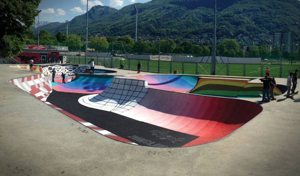
Credit: Zuk Club
- Reverse Graffiti – Activism, Art or Vandalism?
- Famous Graffiti Location “5 Pointz” Set to be Demolished
- Lace Art Used to Transform and Beautify Neglected Urban Spaces
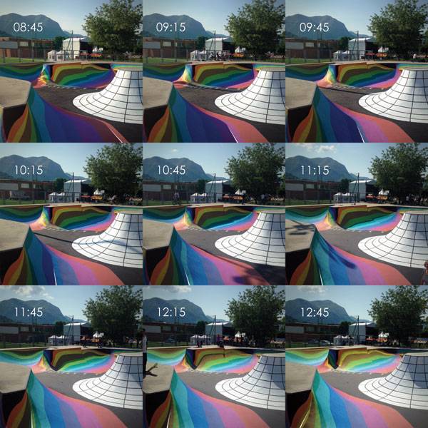
Sundial in action at the skate park. Credit: Zuk Club
Credit: Zuk Club
Credit: Zuk Club
- Dream Builders: The World’s Best Skatepark Creators by Justin Hocking
- Urban Street Design Guide by National Association of City Transportation Officials
Article written by Claudia Canales Return to Homepage

New Piazza Design Turns Dead Space into Vibrant Social Space
Piazza Nember by Valeri Zoia and Stradevarie Architects, Jesolo, Italy. Look at the path. It leads the user to a social nodal space. The Piazza Nember in Jesolo, Italy, by Valeri Zoia and Stradivarie Architects, is a well-designed space for social activities with its pathways of contrasting colors, and play areas that allow children and adults alike to experience the joy of play and meeting new friends. Location The town lies north of Venice, between Eraclea and Cavallino-Treporti. Jesolo gives its name to a lagoon of 22 square kilometers (8.5 square miles) on the Adriatic Sea, between the rivers Sile and Piave. The urbanized area lies on an island of sorts, bordered by the Piave on the east, the Sile on the west, and an artificial canal called Cavetta.
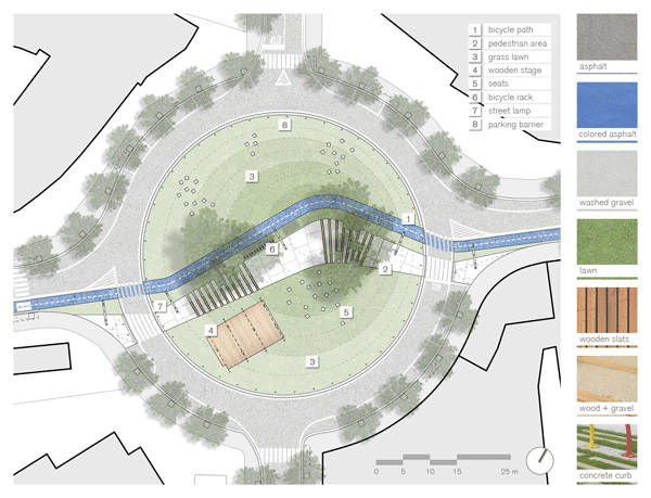
Photo Credit: Piazza Nember by Stradivarie Architettura e paesaggio

Photo Credit: Piazza Nember by Stradivarie Architettura e paesaggio
Photo Credit: Piazza Nember by Stradivarie Architettura e paesaggio
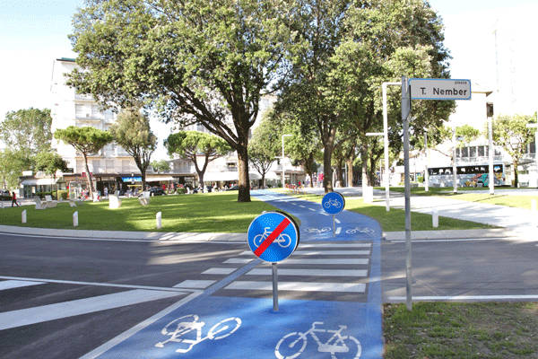
Photo Credit: Piazza Nember by Stradivarie Architettura e paesaggio
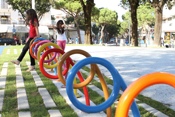
Photo Credit: Piazza Nember by Stradivarie Architettura e paesaggio
The Lighting of the Piazza Design
The lighting system is arranged into four main elements:
- Roadways – Existing luminaries have been preserved.
- Walking and cycling track – Five double-height elements have been placed to light the two tracks simultaneously.
- Green areas – The lighting system focuses only on the single-seater places, to assure an intimate lighting ambiance.
- The stage lighting system – This is defined by a white rood-lighting device.

Photo Credit: Piazza Nember by Stradivarie Architettura e paesaggio
- Car Park Turns into Public Park!
- Community Turn Abandoned Industrial Site into Public Park
- Top Ten Public Squares of the World
The seating system is organized in clusters with different contexts and densities. All the white chairs are single seats and are equally divided into backrests and chair benches made of zinc-plated steel. The idea is to offer users choices of the most comfortable chairs and the most suitable position according to their demand: in a group or more isolated, in the shadows or in a sunny place. A parking area for bicycles has also been added.

Photo Credit: Piazza Nember by Stradivarie Architettura e paesaggio
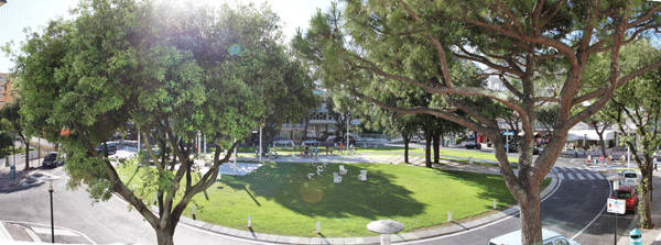
Photo Credit: Piazza Nember by Stradivarie Architettura e paesaggio
- Designing Small Parks: A Manual for Addressing Social and Ecological Concerns by Ann Forsyth
- The Urban Design Handbook: Techniques and Working Methods (Second Edition) by Urban Design Associates
Article written by Sha Sulaiman Return to Homepage


10 Reasons Why You Are Not Getting Hired
10 reasons why you Are not getting hired as a landscape architect. Before you decide not to read this article because its title sounds too pessimistic, consider going ahead anyway — it is here to help you improve your chances of finding your way in the attractive but competitive field of landscape architecture. If you recognize that you are making any of the following mistakes, there is still time to change your ways and land your dream job.
10 Reasons Why You Are Not Getting Hired:
1. Lack of Balance Between Academic and Practical Production

Do what you have to do, in order to get work experience, it will make all the difference. Photo credit: Scott D. Renwick
 3. Not Getting Summer Jobs We have already talked about volunteering with your colleagues throughout the term, and you shouldn’t stop during summer break. It’s even more important to go further by getting work experience in an established business. And if you find it difficult to secure a summer job, imagine how hard it will be to get hired in your specific field if you don’t have an efficient strategy.
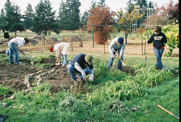
Don’t be afraid to get your hands dirty, all relevant experience counts. Image: A community garden located in Montreal, Canada. Public Domian by Klest

LAN’s Cameron Rodman and Brett Lezon with renowned landscape architect Laurie Olin at an ASLA event; photo credit: Cameron Rodman

Don’t be afraid of the phone, make that call. Credit: Public Domain CC0, source.

A LinkedIN profile page, looks sharp, professional and makes you easy to find.

You can always benefit from the wisdom and insight of a mentor. Credit: CC 3.0

It may feel silly, but in the end at least you’ll be the one with a job. CC0 Public Domain