


Author: John Denise

What Happens When You Fill a Dumpster with Dirt?
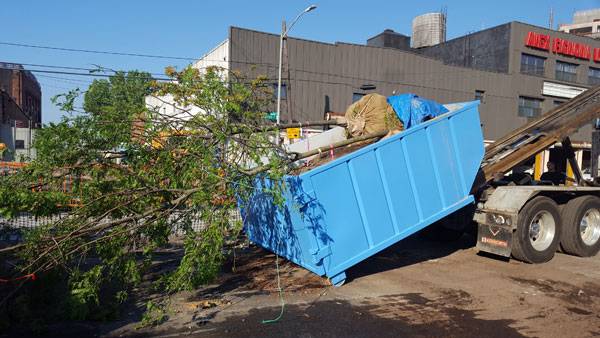
Article by Nick Shannon – We take a look at this innovate urban project, which takes a dumpster and turns it into a growing ground for life. Great conversations are often sparked by something out of the ordinary. If something disrupts your mundane daily activities, it often leads to more thought, questioning, and conversing with others. In the field of landscape architecture, we have the amazing opportunity to utilize this force and intervene in sites to catalyze the user’s perception of environmental issues. In New York City’s Gowanus neighborhood, dumpsters are taking on this purpose to educate the community through a temporary art installation/nursery that provides a visualization of the amount of stormwater a bio-swale can handle. It brings attention to the issue of combined sewage overflows and highlights the importance of green infrastructure in the city’s highly urbanized watersheds. The dumpster is being used as a tool to inspire conversation and action. We will explore how this project came about and what it is doing for Gownaus.
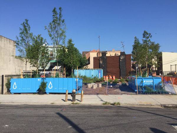
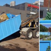
4 dumpsters have been placed at the Gowanus Canal Conservancy’s pop-up nursery site at 431 Carroll St. Photo credit: Gowanus Canal Conservancy
The Gowanus Neighborhood and its Dumpster
The Gowanus Canal is a highly urban and polluted water body. Historically, the Gowanus Canal was a tidal estuary surrounded by farms and mills – a functioning ecosystem before development. When the creek was turned into a canal, it was used to drain the marshland and create a commercial transportation hub that sparked the growth of adjacent industries. At the time, there was little environmental regulation. Waste from the new industries was discharged into the canal without treatment, contaminating the water with industrial pollutants such as coal tar and heavy metals that are still apparent today. The industrialization and urbanization of the Gowanus neighborhood is still a major part of its identity today, and the area still hosts local manufacturing and industrial businesses along the canal. However, the area is rapidly changing, with increasing pressure for residential development.
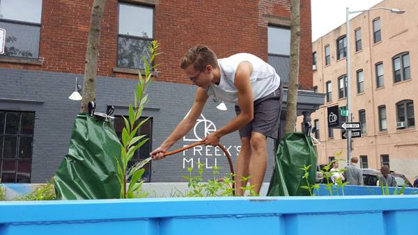
Volunteers are a vital part of the 2,000 Gallon Project. They help water the plants from adjacent fire hydrants. Photo credit: Gowanus Canal Conservancy
The Dumpsters
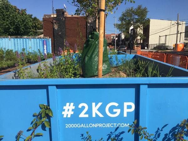
The dumpsters are part of the 2,000 Gallon Project, which consists of 10 2,000-gallon dumpsters that are being used as temporary nurseries and visualization tools to grasp how much water a bio-swale can handle during a rainstorm. Six of the dumpsters are scattered throughout the neighborhood, and four of them have been placed at 431 Carroll Street, the site of a pop-up nursery and stewardship center managed by the Gowanus Canal Conservancy. The GCC holds volunteer workdays, rainwater harvesting workshops, and urban ecology lectures to get people in the community involved in protecting their environment and to encourage a healthy canal watershed.
The dumpsters were installed under the Department of Transporation’s Street Seats program, which encourages the use of parking spaces for pop-up seating to facilitate a social public space – similar to (park)ing day. Two of the dumpsters have seating next to them, and the network of dumpsters spread across the neighborhood encourages community conversation and interaction focused on the health of the Gowanus Canal watershed and environmental stewardship.
What’s in the Dumpsters?
Each of the 10 dumpsters holds two trees and a mix of perennials. The plants are native, and were carefully selected based on their performance in the Gowanus neighborhood to ensure survival when planted on the street.
Compost from the Gowanus Canal Conservancy was mixed with soil to fill the dumpsters at the GCC lot. Photo credit: Gowanus Canal Conservancy
The trees in the dumpsters are:
- Honey Locust Gleditsia triacanthos
- American Basswood Tilia americana
- Swamp White Oak Quercus bicolor
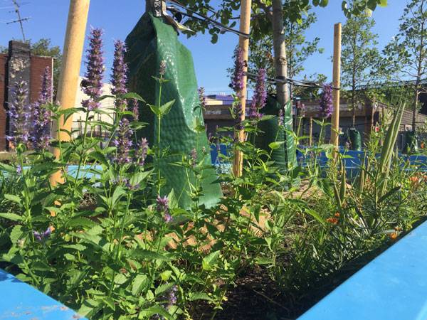
The perennials currently thriving in the dumpsters are:
- Honeysuckle Vine Lonicera sempervirens ‘major wheeler’
- Virginia Creeper Parthenocissus quinquefolia
- Showy Goldenrod Solidago speciosa
- Giant Hyssop Agastache ‘Black Adder’
- Butterfly Weed Asclepias tuberosa
- New England Aster Symphyotrichum novae-angliae ‘Purple Dome’
- Common Milkweed Asclepias syriaca
- Little Bluestem Schizachyrium scoparium ‘Standing Ovation’
- Prairie Dropseed Sporobolus heterolepis
- Purple Love Grass Eragrostis spectabilis
- Adam’s Needle Yucca filamentosa
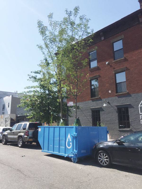
All of these plants are planted in fill soil mixed with compost with a layer of mulch on top to incorporate more nutrients into the soil and help it retain water more efficiently. Every tree has a watering bag attached to it that is filled up using water from adjacent fire hydrants. The perennials are watered with the fire hydrants, as well. Street trees improve air quality, cooling shade, and habitat for birds and wildlife. They also soak up stormwater. Mature trees manage up to 4,000 gallons of stormwater per year — the equivalent of two dumpsters. The Gowanus neighborhood has a lack of street trees, and it is sweltering to walk on the streets during the summer. This project serves as a nursery for 20 new street trees that will be planted this fall on streets throughout the neighborhood.
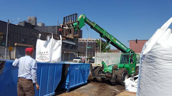
The dumpsters were moved from the nursery lot to their locations around the neighborhood. Photo credit: Gowanus Canal Conservancy
Pollution and Clean Up
Combined sewage overflows are the main source of pollution still entering the canal today, and green infrastructure is an easily implemented solution to reduce the amount of raw sewage emptying into the water. A total of 377 million gallons of combined sewer overflow enter the canal each year, and each 2,000-gallon dumpster provides visual representation of the immense scope of the problem. There is no single solution, but rather a collection of small-scale interventions that can add up to make a difference. The dumpsters are only part of the story; they are a small-scale intervention that is making a difference while planning for larger infrastructure is under development. People are awakening to the problem of the contamination and are starting to respond to the canal’s environmental and health concerns. Today, the health, smell, and water of the canal are starting to turn around.
Trees from the dumpsters will be transplanted into tree pits around the neighborhood, where they will continue to provide ecosystem services. Photo credit: Gowanus Canal Conservancy
A Superfund Site
The Gowanus Canal was recently designated as a Superfund site, which has sparked action to clean up the contaminants. In the next decade, the canal will be dredged to clean up 10 feet of contaminated sediment. The flushing tunnel at the mouth of the canal was recently upgraded by the Environmental Protection Agency and is now more efficient in bringing oxygenated water from the East River. This has improved the smell of the water, and people are starting to change their perception. Two new stormwater tanks are also being built, which will greatly reduce the amount of raw sewage that overflows into the canal. These projects, in conjunction with a network of bio-swales, rain gardens, and tree pits, will greatly decrease the amount of stormwater contributing to combined sewage overflows. Bio-swales The dumpsters are a visualization of the water one bio-swale can handle during a storm event. So what are the functions of these bio-swales? Every new bio-swale will keep 2,244 gallons of stormwater out of the combined sewer system. The surface runoff from the road carries contaminants and is directed to the bio-swales through a curb cut, infiltrating the water into the soil through a gravel-and-sand retention base that cleans the water while keeping it out of the stormwater pipes.
Every new bio-swale installed in the watershed prevents the amount of stormwater that could be contained in a dumpster from entering the combined sewer system. Photo credit: Gowanus Canal Conservancy
Future Steps
The 2,000 Gallon Project is not just a temporary installation; it will have lasting effects long after the dumpsters are gone. The trees in the dumpsters will be planted around the neighborhood in vacant tree pits to increase the canopy cover, provide shade during the summer, soak up more stormwater, and provide critical habitat. So what happens when you fill a dumpster with dirt? It becomes a valuable educational tool that contains a micro-urban ecosystem that gets people talking about environmental concerns. A win-win for everybody. A cleaner Gowanus Canal is made possible through efforts like this, paving the way for increased biodiversity and cleaner air and water in the future. We need to protect our environment for future generations, and starting small but thinking big is the only way to get there!
1. Dumpster at 550 Sackett St. – one of 10 positioned around Gowanus. Photo credit: Gowanus Canal Conservancy
- Becoming an Urban Planner: A Guide to Careers in Planning and Urban Design by Michael Bayer
- Sustainable Urbanism: Urban Design With Nature by Douglas Farrs
Article by Nick Shannon

How Residential Living Can Become a Lush, Tropical Resort
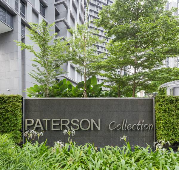
Article by Nick Shannon Residential Living at the Paterson Collection, by Ong Ong , in Singapore Landscape architects hold a huge responsibility to design environments that people will occupy for years to come. The decisions we make have a direct impact on the everyday lives of the end users, which is a very powerful idea. We have the potential to create a positive influence in other people’s lives. Bringing the function and aesthetic of a landscape to the forefront of a design is one of the ways to create an impactful design, and this is accomplished again and again by Ong Ong in Singapore. Imagine a lush, tropical resort, and then imagine living there every day. This is what the Paterson Collection exemplifies, creating a connected landscape experience that functions, educates, and performs.
Patterson Collection. Photo courtesy of ONG ONG
Residential Living at The Paterson Collection
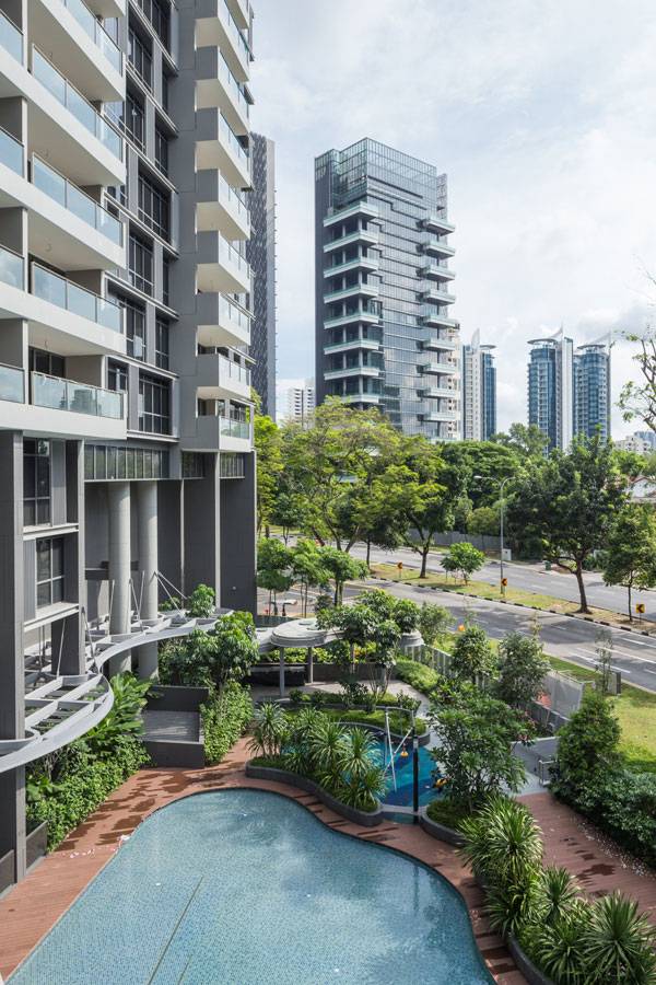
The Paterson Collection is a complex of two 19-story condominiums located in the River Planning Valley of Singapore. It is part of a larger residential community located between Orchard Road (the city’s main drag) and the Singapore River. The River Valley district is a popular eating spot for locals, and provides a high quality of living within the urban environment in close proximity to the downtown core.
Patterson Collection. Photo courtesy of ONG ONG
Patterson Collection. Photo courtesy of ONG ONG
Landscape Connectivity
One of the most important aspects of landscape design is to create a connected experience. The building, hardscape, amenities, and plantings need to complement each other and work together to create comfortable spaces that people will want to use. The placement of the buildings at the Paterson Collection, and how the landscape interweaves between and around them, gives the design a curvilinear and coherent quality. This is coupled with small, intimate areas and larger gathering spaces to give people a choice of interaction – something that is essential in designing any public space! You never know how people will use the space, so it is best to provide a diversity of options so they can choose a use based on their needs at the time.
Patterson Collection. Photo courtesy of ONG ONG
Recreational Amenities
The tropical resort vibe really pushes through the whole experience of this site. The premise of the project is to provide residential living with family amenities and a modern, tropical resort feel. It makes people want to be outside and is strengthened through bringing a recreational aspect to the forefront of the design.
Patterson Collection. Photo courtesy of ONG ONG
Multi-Functional Tropical Resort
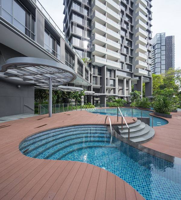
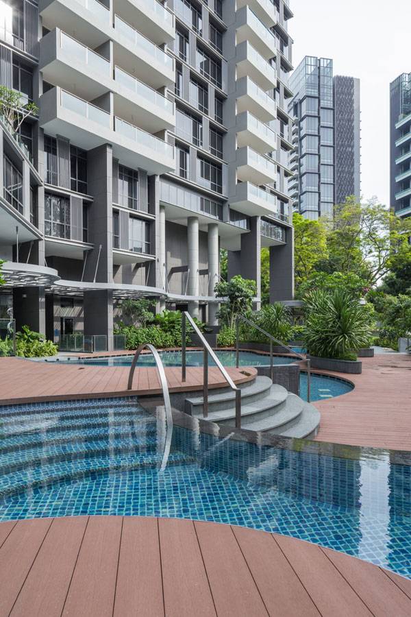
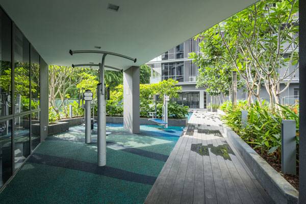
The condominium complex provides family-oriented amenities that bring people outdoors into the landscape to exercise and enjoy their surroundings. One of the ways to stay active in this complex is to workout in the lap pool, surrounded by plantings that provide shade and privacy. There is also exercise equipment in the spa pool, coupled with hydrotherapy jets so you can enjoy a nice day of relaxation after getting in a workout. There is even a playground for kids with a soft rubber ground surface, providing amenities to families who live in the towers. Adults can take advantage of the second-story terrace that features a pool and a gym, which extends outdoors with yet more equipment.
Patterson Collection. Photo courtesy of ONG ONG
Patterson Collection. Photo courtesy of ONG ONG
Tropical Plantings
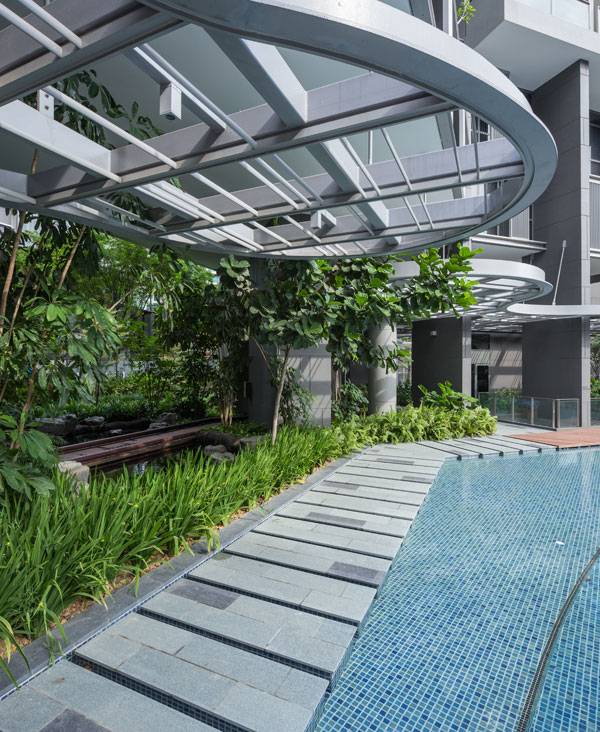
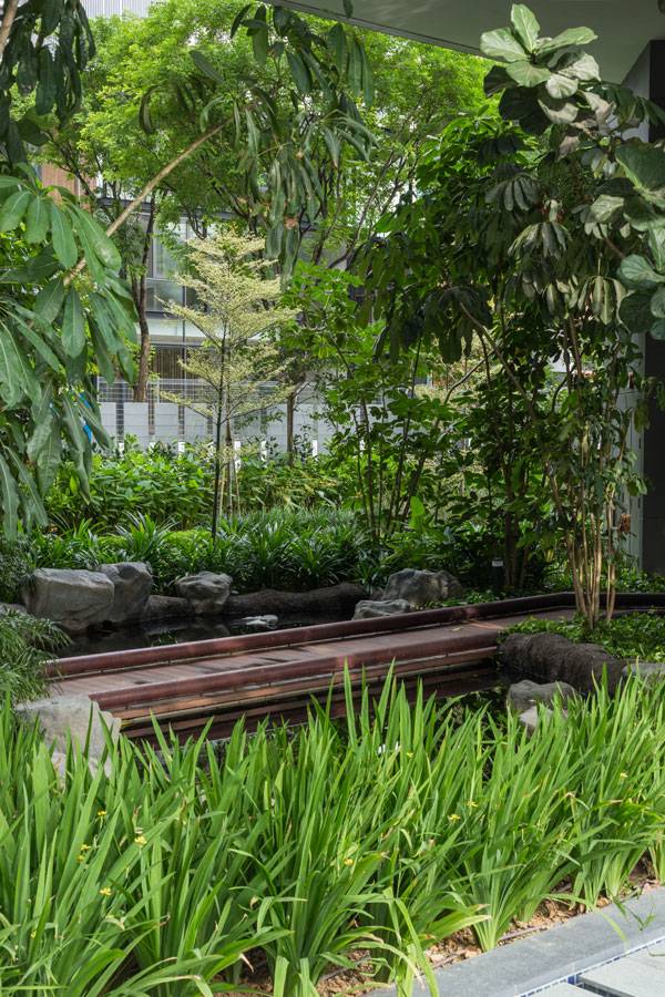
Landscape architects change the way people interact with their environment with landscape design. One of the most effective ways to connect people with nature is through planting design. The value of vegetation goes far beyond its dollar value – plants provide ecological function, a particular aesthetic quality, and can enhance design decisions such as form, privacy, scale, and feeling. The tropical planting palette at the Paterson Collection allows residents to discover the native flora and fauna of Singapore, while providing aesthetic appeal. A variety of flowering trees, broad-leafed shrubs, and smaller grasses combine to showcase a variety of textures and characters that changes throughout the space. These plants also provide value through habitat and their ecological function. The native plants used in this design filter excess rainwater through a bio-swale and bio-pond. These are not your typical bio-swales either; they are covered with dense plantings, educational signs, and the bio-pond has a timber bridge that crosses over the center to allow for even more interaction with the stormwater feature.
Patterson Collection. Photo courtesy of ONG ONG
Being Immersed in the Vegetation
Take a walk on the timber bridge and feel completely immersed in vegetation. The diversity of plantings really evokes a sense of the natural condition, and large rocks complement the concrete structure of the building. Flowering trees provide a canopy overhead while smaller grasses and shrubs function to filter the rainwater. The bio-swale features a gravel channel in the center for water conveyance, emphasizing the importance of utilizing stormwater. Vegetation surrounds the channel and functions in filtering pollutants and absorbing water. When you walk on the path bordering the bio-swale, you have tall, broad-leafed grasses by your side and feel connected to its function.
Patterson Collection. Photo courtesy of ONG ONG
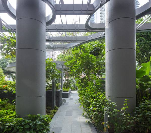
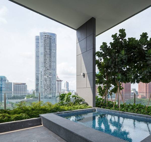
The Sky Gardens
The gardens are not only on the ground, but in the sky as well! The site features a 3-meter-high green wall and two sky terraces that provide an elevated experience with views of the landscape and the city. Small trees and shrubs border the space and you get the experience of being in the canopy of the trees. The sky terraces are highly designed and specified to fit within the structure of the building, and also feature a pool as well! The plant palette works seamlessly with the resort vibe, while providing added ecosystem function. This is made possible through the careful choreography of water.
Patterson Collection. Photo courtesy of ONG ONG
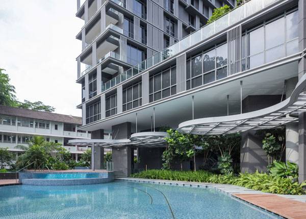
Water Features
A tropical resort isn’t complete without water. The Paterson Collection features three main pools that are perfect for relaxation and recreation, as well as the bio-swale and pond water conveyance features. The wading pool is designed with a sloped edge to mimic a beach setting, and a modern continental dock is a natural extension of the building to the pool.
Patterson Collection. Photo courtesy of ONG ONG
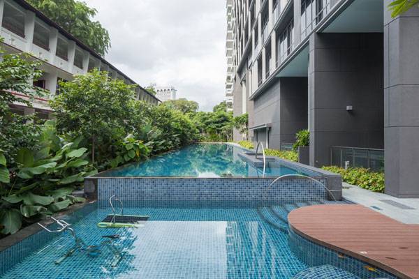
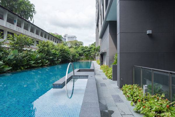
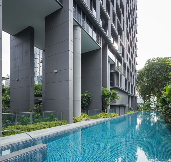
50-Meter Lap Pool
Raised concrete planters separate the vegetation from the deck, where the vegetation overflows and becomes part of the space. This pool is accompanied by a spa pool with hydrotherapy jets and an aqua gym, with a hot tub on one side of the pool deck, with lounge seats. There is even a 50-meter lap pool in the rear side of the development, the perfect place to get in a workout. The undulating forms of the pool piece together the water and wooden deck in a complementary manner, and create a variety of spaces to relax. Plantings border the pools to bring the natural environment up close, and function to provide shade and privacy.
Patterson Collection. Photo courtesy of ONG ONG
Modern Tropical Resort
Not only do the plantings and landscape function, but they evoke Singapore’s tropical vibe. A resident of these buildings will experience and live within it everyday, and feel a sense of connectedness to nature. This is what we get to design; a sense of responsibility and stewardship that people need in their lives! Would you want to live here? What is your favorite aspect of the design?
Patterson Collection. Photo courtesy of ONG ONG
Full Project Credits For Paterson Collection :
Project Name: Paterson Collection Designers: Ong Ong Location: Singapore Area: 5,791.50 square meters Date of completion: 2014 Recommended Reading:
- Becoming an Urban Planner: A Guide to Careers in Planning and Urban Design by Michael Bayer
- Sustainable Urbanism: Urban Design With Nature by Douglas Farrs
Article by Nick Shannon

How to use Water in Landscape Design – The 5 Best Projects That Show You How
Aritcle by Nick Shannon We explore 5 projects that show you how to use water in landscape design. We use water every day, and in so many ways. It is such a ubiquitous resource, but we often don’t think twice about using it or how it is handled within hidden infrastructure. In the landscape, water is what sustains life and civilization. We need it to survive and thrive, and access to healthy, potable water is a pressing concern that the field of landscape architecture can really impact. Water needs to be addressed and to be regarded as a precious resource, as well as an opportunity to create sustainable landscapes that function well and are designed for humans, wildlife, and the environment. Here are 5 extraordinary projects that will inspire you to think about the many different ways to use water. Sustainable water management is not just for the environment, but for people and wildlife as well. (Click on any of the images to find more information about the project)
Water in Landscape Design
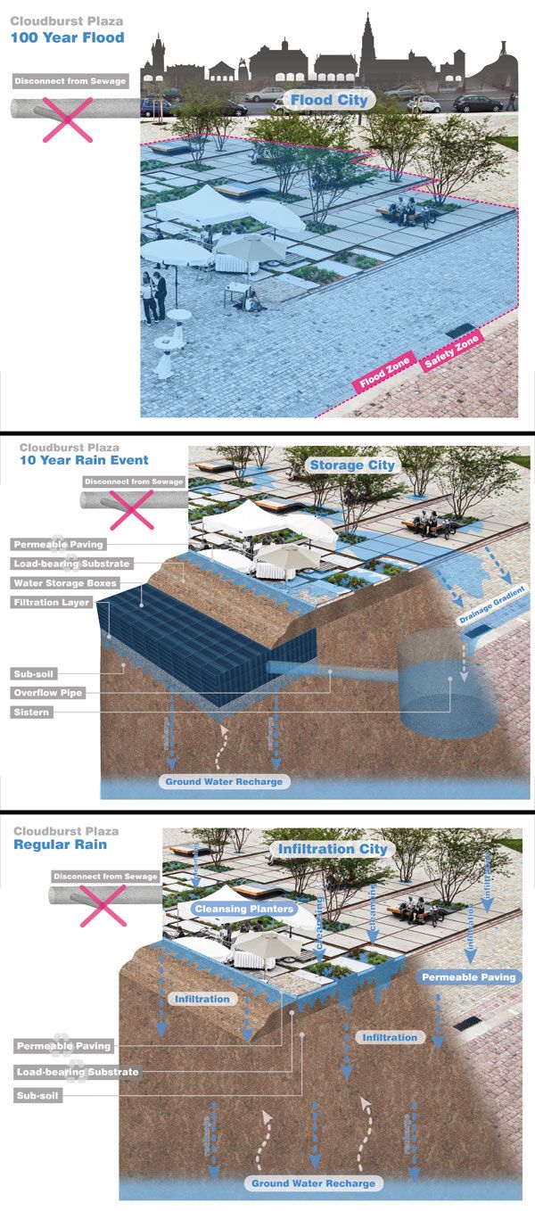
5. INFILTRATION Zollhallen Plaza by Atelier Dreiteilt in Freiburg, Germany The water we drink depends on ground and surface water to recharge bodies of water, reservoirs, and wells. When it rains, water infiltrates into the ground and recharges the ground water, but in urban areas, pavement intercepts this cycle and moves water away from the place it fell. The first way to effectively use water is to infiltrate it. Let it naturally seep into the ground to recharge the ground water and bring back the natural function of the landscape. Zollhallen Plaza in Freiburg, Germany, keeps stormwater and runoff from flowing into the sewer system; it was designed to handle all of it on-site. Permeable pavers allow water to pass through the hardscape, and the grading of the plaza directs water towards planting areas. Cisterns are also used to capture the water from a 100-year flood event and hold it until it can infiltrate into the soil. This plaza is a beautiful site that handles water in an efficient way. Zollhallen Plaza shows us that it is possible to think outside the box and don’t just pave everything – infiltrate first! Any new development today has to deal with at least some of the stormwater on-site, but doing it all takes this project to the next level. It creates a more resilient water management system.
Zollhallen Plaza. Image credit: Atelier Dreiseitl
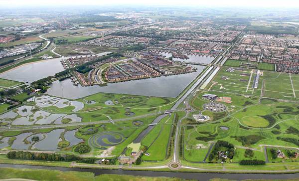
Pre-treatment swales gather freshwater, filter it with plants, and hold it in the wetlands until it can be infiltrated. The agricultural fields were rearranged to accommodate the restoration and their edges were forested to protect the citrus crops. This integrates human activity with natural systems that work in harmony. Landscape architecture has the potential to push this idea and use water to our advantage, and other species’ advantage, as well. 3. PURIFICATION Park van Luna by HOSPER in Heerhugowaard, the Netherlands Using water in design is not just about collecting and infiltrating. Purifying the water and cleaning up the pollution it carries not only leads to a healthier community, but a healthier environment. Water management can be subtle, or in-your-face, like Park van Luna in the Netherlands. Here, a residential development is integrated with recreational opportunities and a large body of water that reduces floods, preserves wetlands, and harvests stormwater. Part of the larger City of the Sun, the whole development will run on renewable solar energy, making it carbon neutral. It is on an island, surrounded by a 60 ha lake, so it just makes sense to embrace the water and manage it in a unique way. Reducing our climate footprint, while preserving the environment, is how the field should push new development in the future. Out of a total of 177 ha, 75 ha are dedicated to open space and sports; activities that promote social interaction. A 1 km beach, sports center, and walking /cycling paths, encourage a healthy community. In regards to using water, this project excels in the purification of the water it is so integrated with. A natural purification plant, a de-phosphatizing pond, and a pumping station all encourage residents to interact with and learn about the systems. The system was also designed to store a large amount of water to be used during the summer months.
Heavily integrated mixed water uses. Credit: HOSPER
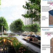
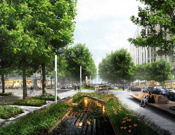
1. SMALL SCALE SITES ADD UP Ecodistricts, in Southwest Washington, DC, United States One of the most efficient and easily-implemented ways to deal with water in the environment is through a network of small-scale interventions that mitigate runoff and pollution. Designing a system is what works, and is how new development should be tackled – it creates a cohesive landscape that addresses issues in every way. Imagine if every new renovation and street incorporated stormwater plantings on it. The benefits add up quickly and result in an efficient system overall. This is exactly how the SW Ecodistrict in Washington D.C. was designed. As a planned mixed-use neighborhood, SW Ecodistrict incorporates sustainability in every detail. Rich street life is achieved through green streets and a greenway that accommodates biking, walking, and urban agriculture. Excess stormwater is captured in tunnels which bring it to be treated and reused as freshwater for the neighborhood. Every surface is maximized for efficiency – food is grown on roofs, streets, and the sides of buildings. The streets are lined with stormwater swales that are beautiful, attracting wildlife and people, while functioning on an environmental level. This project really fosters community stewardship and sustainability. The stormwater tunnels move water and bring people to connect with natural systems, incorporating them into the streets where they can become an asset.
An EcoDistrict. Image coutesy of ZGF ARCHITECTS LLP
Water in Landscape Design
Water can be utilized in so many ways, and these projects prove to be exemplary examples of just a few of the innovations in water management. Stormwater should not be viewed as something that we ‘have to’ deal with, but rather as an opportunity to create a more sustainable and efficient community that brings people and nature together as one. Use some of these ideas to think about the water cycle and engineered infrastructure in new ways, related to design as a whole – incorporating water, people, buildings, and nature into a dynamic harmony. What is your favorite project that uses water in an exciting way?
Recommended Reading:
- Becoming an Urban Planner: A Guide to Careers in Planning and Urban Design by Michael Bayer
- Sustainable Urbanism: Urban Design With Nature by Douglas Farrs
Aritcle by Nick Shannon

10 Awesome YouTube Tutorials to Master Rhino
Article by Nick Shannon In this article, we will explore how you can start making awesome 3d models in Rhino, a useful tool in conceptualizing and testing designs. The field of landscape architecture requires a broad range of tools to communicate the analysis and design of a site. One of the most effective tools we have is the visualization of the landscape, through perspective drawings, sections, models, or plans. Many ideas are thrown out on trace and through sketching, but computer programs take the initial idea to the next level. 3-D modeling software is becoming a key communication tool for landscape architects to collaborate on projects with interdisciplinary teams and clients. Rhino is one of the most user-friendly programs out there, and there are plenty of helpful tutorials to help you maximize your use of the program. The best way to learn is to create and practice your skills, so get out there and start playing around with Rhino. Download a free 90-day trial of Rhino 5 here: https://www.rhino3d.com/download You can learn just about anything through YouTube tutorials, but sometimes it’s hard to find the right ones. Here is a list of the best YouTube tutorials for Rhino so you can start your search. 10. Introduction to Rhino Rhino feels similar to AUTO CAD, and they share some of the same commands. However, if you have never used the program before, it is essential to get accustomed to the basic layout and commands of its interface. Make sure you start off with the right units; then you can begin to draw in three dimensions. The great thing about Rhino is that you can easily use four viewports while drawing: Top (plan), Perspective, Front (section), and Right (section). This gives you flexibility while drawing to make sure the right points are being selected. To move around in the viewports, all you have to do is right click. Watch the tutorial and follow along to start getting accustomed to the interface. The basic commands are covered in this video … start drawing! WATCH >>> Rhino 3D Beginners Tutorial and Tips
9. Curves and Surfaces Any site we work on is made up of a variety of structures, forms, and systems. The basic elements of a design can almost always be pulled apart into solids, curves, and lines, all of which you can create and edit in Rhino. You cannot have a solid object in Rhino; the closest thing is a water-tight poly surface. Curves can be made from a line through the commands in the command line. Polylines are a chain of lines, and the polyline command should be used to draw for greater flexibility. Rhino uses control points, which can be turned on or off and manipulated for easy edits after the fact. The curve command can be used to create a curve from control points of a polyline. You can also use a command to turn polylines into a curve. As in AUTO CAD, there are ortho and object snap parameters. These can be turned on and off at the bottom of your screen. Hold control to move in and out of the plane (be aware that some commands are only available if everything is on one surface, but there are ways to get around that). You can also make surfaces from curves, from extrude, solid (for a closed curve), planar surface (for curves within a single plane), trim, edge surface, or loft (this is helpful while designing walls). WATCH >>> Rhino tutorial 4 surfaces
8. Site Topography Model One of the first things to visualize on a site is the topography. If you are lucky enough to have contour data, you can certainly bring it into Rhino from AUTO CAD to create a surface of the existing conditions. At minute 17:00, the second part of the tutorial explains how to create a model from contours. For this to work, the contours in AUTO CAD have to be set at their correct elevations so you can create an accurate surface in Rhino. The great thing about importing into Rhino is that it keeps the layers. The patch command is used because the contours are so complex. Extracting the points is the first step, then the patch command can be utilized. This creates a surface over the points. The next step is to trim the surface to the bounds of the site. Projecting the property line onto the surface allows the trim command to work. The contour surface is a great tool to start visualizing your site. Although it is not 100 percent accurate, it is pretty close! WATCH >>> Digital Fundamentals Week 3 – Introduction to Rhino and Site Model
7. Topography from Google Earth If you do not have contour data available, or want to visualize a larger swath of the landscape, topographic data from Google Earth is readily available for your use. This tutorial starts in SketchUp, and the great thing about Rhino is that it allows you to import models from SketchUp. The surface can be manipulated further in Rhino and patched to create a solid NURBS surface. This means that the surface is available for use in Rhino and across other programs. NURBS stands for non-uniform rational B-spline, which just represents 3-D geometry. WATCH >>> Topography from Google Earth
We often start to analyze a project from the large scale to understand the systems and processes that shape the site and to test interventions in the existing framework. This starting point can add context to your work to create a comprehensive design. 6. Extruding Along a Curve A lot of designs involve curvilinear forms. They add interest to the landscape and encourage a distinct flow of people or design elements. Extruding along a curve can become really helpful while creating benches to navigate complex geometry. The uses are endless, but some of them may include benches, retaining walls, shelters, or structures. Play around with your design and see what works, then go back and try it again! The great thing about 3-D modeling programs is that they aren’t built yet, so you have the flexibility to try different ideas. WATCH >>> Intro to Rhino 5 – Extruding Along A Curbe – The Tutorials for Landscape Architects
5. Lands Design – Rhino Plug-in Lands Design is a landscape architecture plug-in for Rhino. It is really helpful to get a rough visual of a site with vegetation that you design. The plant database allows you to insert plant species and specify every detail, from age, scale, length, thickness, branch length to crookedness. The plug-in creates a fully customizable landscape program that gives your design more flexibility and character in the 3-D world. If used with the Flamingo nXt plug-in, this program can help create beautiful 3-D visualizations from Rhino. It allows for a variety of rendering options to customize your design and its presentation. Go to this YouTube channel to find more videos of how to use Lands Design. WATCH >>> Lands Design Rendering & Visualization
4. Grasshopper Introduction Grasshopper is a confusing but useful tool to use as a plug-in in Rhino. It uses numbers, formulas, and manipulators to create geometric concepts. It is certainly not a substitute for design, but Grasshopper can help create geometric forms through parametric design (using constraints to design a model). There is no one tutorial for how Grasshopper can be applied to landscape architecture. It truly depends on the project and site, but it does provide the opportunity to explore different ways of looking at the design process. WATCH >>> Grasshopper Tutorial Video 001
One of my studio projects used Grasshopper to simulate tides in Newark Bay – it is an amazing program to test interventions within existing systems. A video of the simulation can be found here. 3. Flamingo nXt Rendering in Rhino Flamingo nXt is a photo-realistic rendering tool for Rhino and creates powerful images from your 3-D model. If you have enough elements in your model (topography, vegetation, buildings, and structures), you can create an environment in the background to render it into an image. Flamingo allows you to set the background and lighting to create the environment you want in your final image. It is a great tool to make your model look that much more realistic. WATCH >>> Rhino 4 – Flamingo NXT Basic Background Environments
2. V-ray Rendering in Rhino V-ray is another powerful rendering tool for Rhino. The options to select materials and control the direction of light gives you flexibility in the final image that comes out of Rhino. Not only does V-ray give you options for materials, you get to select camera options and rendering quality. It is a more powerful tool than the basic render that comes with Rhino and will result in higher-quality images with detailed materials. It will create a great base for an awesome Photoshop perspective! This YouTube channel has other tutorials that go in-depth into the different tools V-ray has to offer. WATCH >>> [Vray for Rhino Tutorial] 01 VRay Intro
1. Rhino to Photoshop Once you export any image of your model from Rhino, it will probably need a little more work in Photoshop to perfect your perspective. Rhino is one of the best tools for getting the framework of your design, but Photoshop can push it to the next level. Play around with filters, lighting, color, and mood in Photoshop to create a convincing perspective that will sell your design. And if you are showing a landscape, be sure to put in people! Once you populate the perspective with people (don’t forget their shadows), it will subconsciously convince your client that this will be a successful landscape. Watch this video to learn some techniques that will create a photo-realistic image. WATCH >>> Architecture Visualization Render | Photoshop Post Production 2
Rhino is a powerful 3-D design program where you can accomplish anything from visualizing to testing design ideas. A 3-D model opens up endless possibilities to analyze a site and test ideas. It is also a powerful communication tool; people love 3-D models and are always impressed with images from them. It is just easy to visualize a design if you have explored it three-dimensionally — proof you can show the client. Just make sure you save your work constantly! Iteration copies will be your best friend. What is your favorite tool in Rhino? Go to comments Recommended Reading:
- Drawing for the Absolute Beginner: A Clear & Easy Guide to Successful Drawing (Art for the Absolute Beginner) by Mark Willenbrink
- You Can Draw in 30 Days: The Fun, Easy Way to Learn to Draw in One Month or Less by Mark Kistler
Article by Nick Shannon

Revitalized River Will Make You Wonder Why It Was Blocked Off
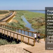
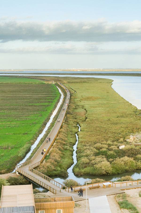
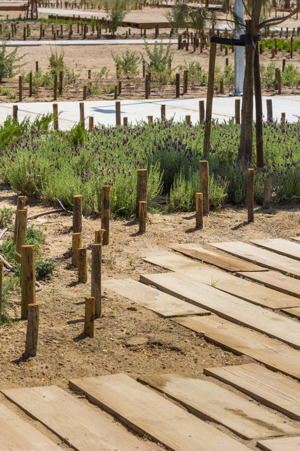
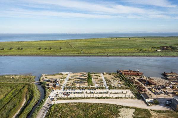
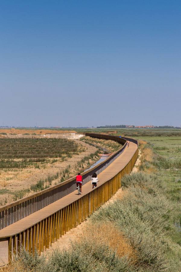
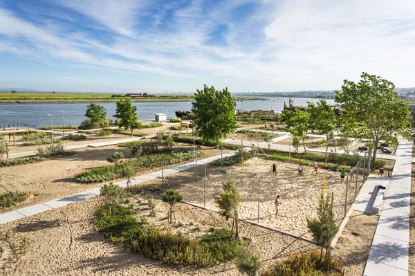
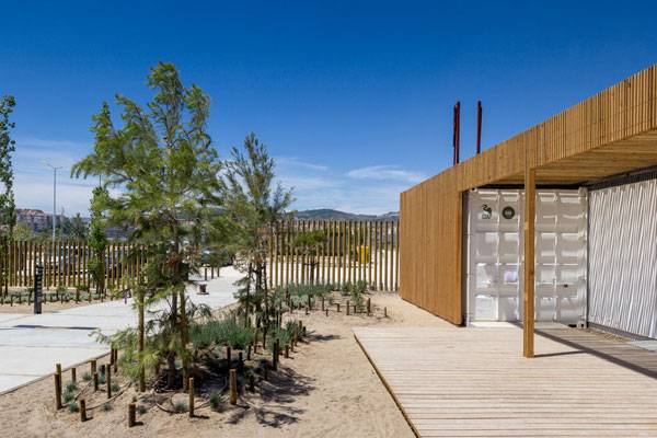
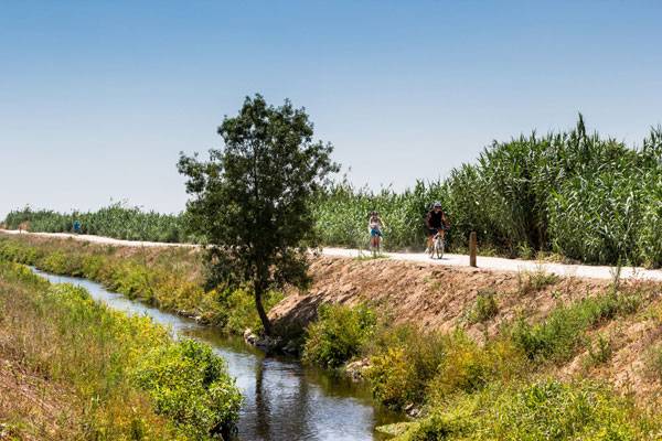
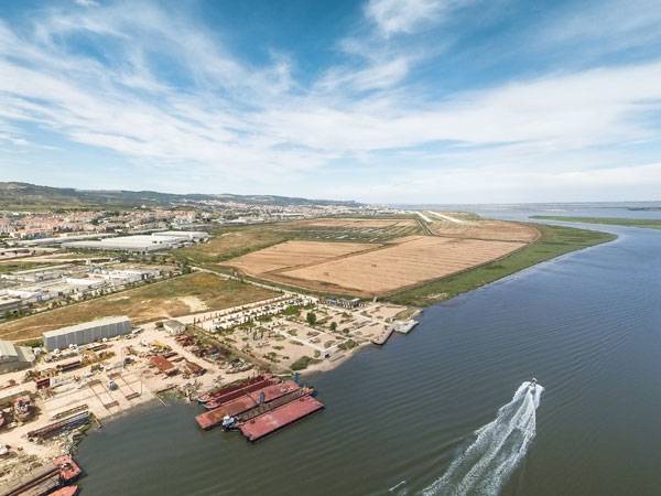
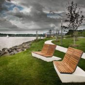
Article by Nick Shannon Tagus Linear Park, by Topiaris Landscape Architecture, in Póvoa de Santa Iria, Portugal. Water is the most important resource on earth, and everything we do as landscape architects has an impact on water in one way or another. It is a major part of why cities are located where they are, and the interface between land and water is a dynamic zone where development often occurs. Man has altered the shore condition through building on floodplains or under sea level, causing damage in the long term. Today, we need to make waterfronts more resilient through new development and design while encouraging public access through public space. The field of landscape architecture can become a leader in this movement, and a lot of projects are addressing these issues. Topiaris Landscape Architecture has done this in the riverside city of Póvoa de Santa Iria, Portugal, through Tagus Linear Park. The restoration of the natural environment turned an industrial barrier along the river into new public space that encourages visitors. WATCH >>> Tagus Linear Park – Topiaris Landscape Architecture
Tagus Linear Park
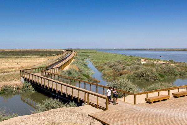
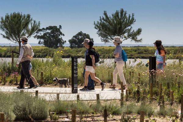
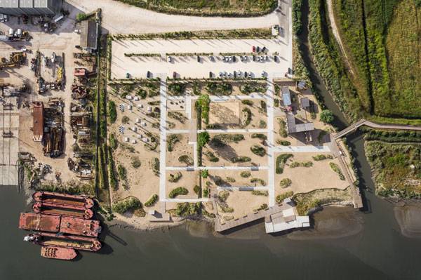
We will explore how this park revitalized an industrial landscape and increased access to the riverfront. Context: City, Industry, and Water Situated along the Tagus River, Tagus Linear Park breaks through the industrial riverfront to give the community public access to the water. The site was dominated by industry and farmland, giving little attention to the natural marsh ecology or public access and recreational opportunities.
Tagus Linear Park. Photo credit: Joao Morgado – Architecture Photography
Tagus Linear Park. Photo credit: Joao Morgado – Architecture Photography
Tagus Linear Park. Photo credit: Joao Morgado – Architecture Photography
Tagus Linear Park. Photo credit: Joao Morgado – Architecture Photography
Tagus Linear Park. Photo credit: Joao Morgado – Architecture Photography

Tagus Linear Park. Photo credit: Joao Morgado – Architecture Photography
Tagus Linear Park. Photo credit: Joao Morgado – Architecture Photography
Tagus Linear Park. Photo credit: Joao Morgado – Architecture Photography
Tagus Linear Park. Photo credit: Joao Morgado – Architecture Photography
Tagus Linear Park. Photo credit: Joao Morgado – Architecture Photography

Tagus Linear Park. Photo credit: Joao Morgado – Architecture Photography
Tagus Linear Park. Photo credit: Joao Morgado – Architecture Photography
Tagus Linear Park. Photo credit: Joao Morgado – Architecture Photography
Full Project Credits For Tagus Linear Park:
Project Name: Tagus Linear Park Parque Linear Ribeirinho Do Estuário Do Tejo Location: Póvoa De Santa Iria, Portugal Area: 15 Ha Client: Municipality Of Vila Franca De Xira Completion Date: July, 2013 Landscape Architecture: Topiaris, Landscape Architecture
Recommended Reading: Design with Nature
Ian L. McHarg. Get it HERE!
- Becoming an Urban Planner: A Guide to Careers in Planning and Urban Design by Michael Bayer
- Sustainable Urbanism: Urban Design With Nature by Douglas Farrs
Article by Nick Shannon

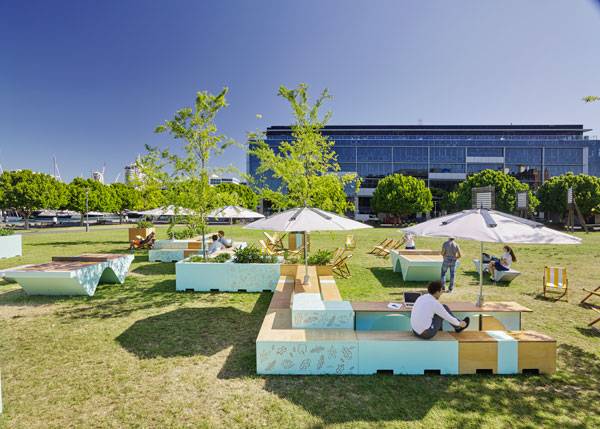
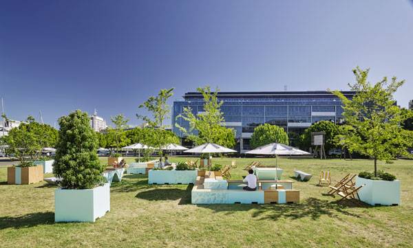
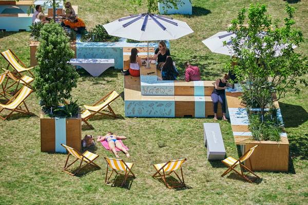
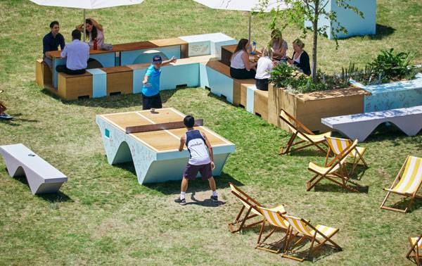
How This Pop-up Park Engages an Excited Community
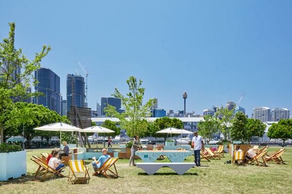
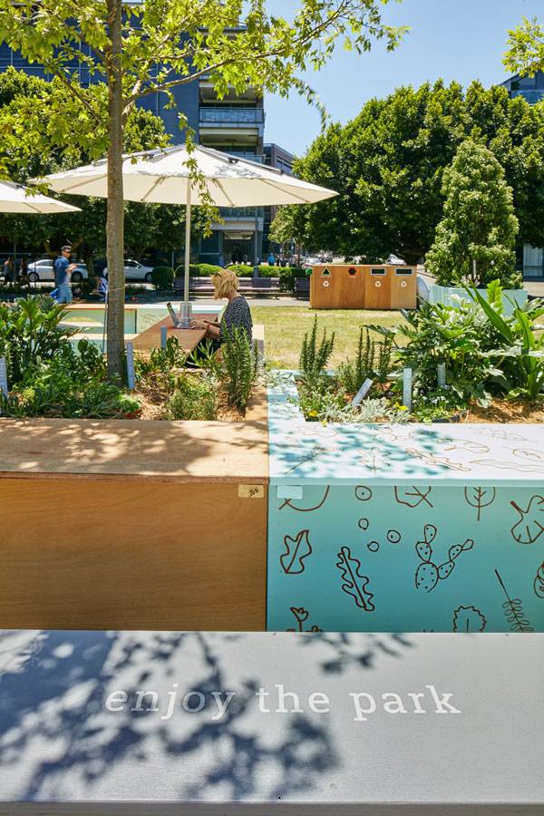
Article by Nick Shannon Pop-up Park in Metcalfe Park, by ASPECT Studios, in Sydney, Australia. Landscape architecture is a profession that brings uncertainty. When designing a site, it is necessary to research and analyze existing conditions in the beginning, but after a project is implemented, natural and human processes usually change the landscape in unexpected ways. We can never fully predict how people will use a space, or what they would want, but research and analysis can help to create an informed design. Testing ideas is another way to ensure functionality and the thriving movement of temporary landscapes does just that. They act as a space to test site elements that encourage people to use public space, whether it be a pop-up-park, park(ing) day or an art installation. Temporary design is an exciting way to activate an existing park or public space to create new uses and identity.
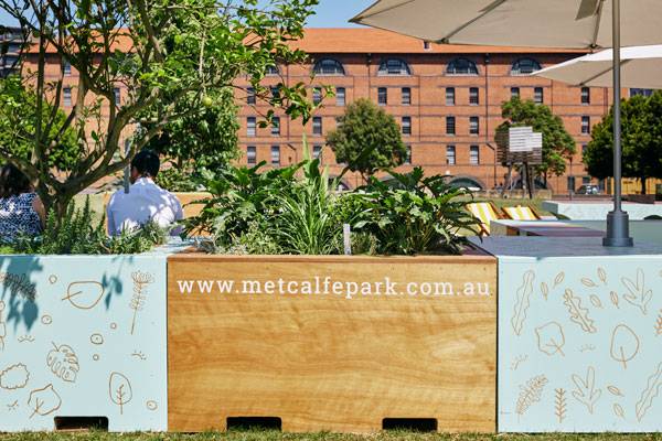
Metcalfe Park. Photo credit: Florian Groehn
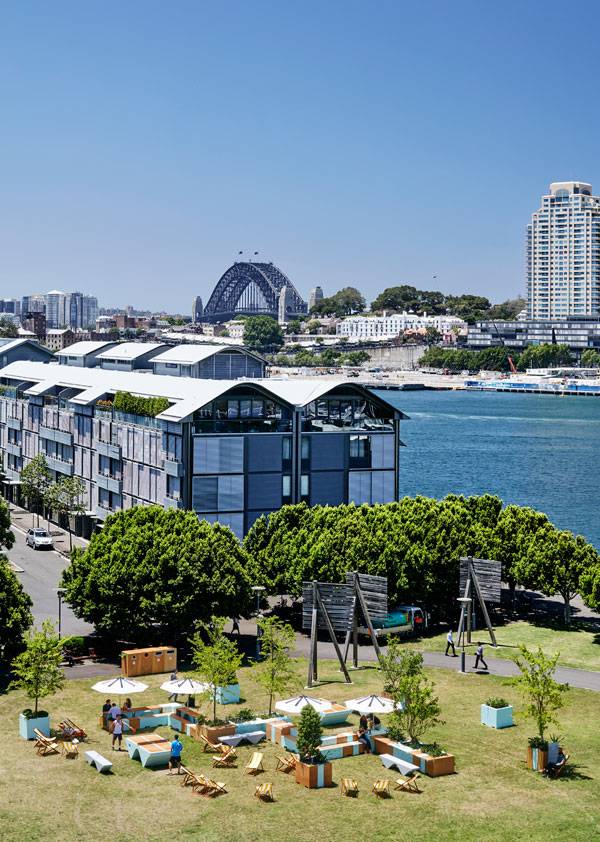
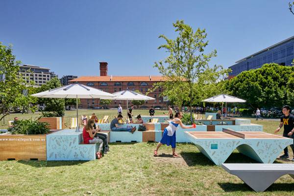
Metcalfe Park
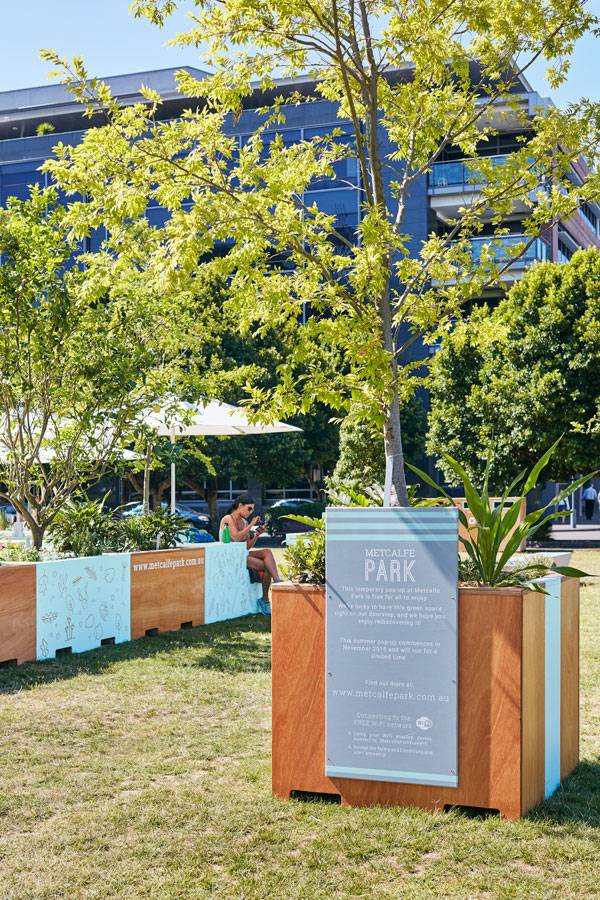
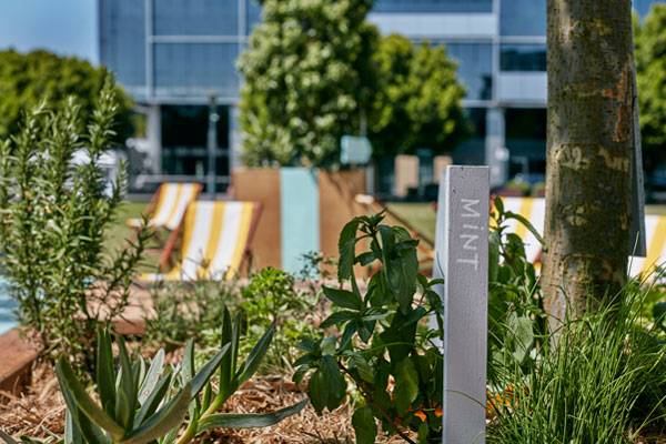
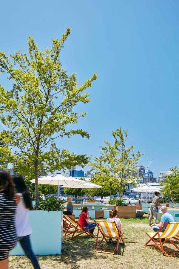
Metcalfe Park, by ASPECT Studios in Sydney, Australia, created a park within their park through community support and engagement to give the residents a space to stay, exercise and play. We will explore why this had to be done and how the temporary park was designed within its context. Breathing Life into an Existing Park Metcalfe Park is hidden between two buildings within Pyrmont’s commercial and technology precinct in the city of Sydney, Australia. Previously just a vast open lawn, the space was not used to its full potential. Although it’s in a great location featuring views of the western city edge of Sydney, it didn’t accommodate any programming or amenities for its users so people just used the park as a transitional space to walk through or around.
Metcalfe Park. Photo credit: Florian Groehn
Metcalfe Park. Photo credit: Florian Groehn
Metcalfe Park. Photo credit: Florian Groehn
Metcalfe Park. Photo credit: Florian Groehn
Metcalfe Park. Photo credit: Florian Groehn
Metcalfe Park. Photo credit: Florian Groehn
Metcalfe Park. Photo credit: Florian Groehn
Metcalfe Park. Photo credit: Florian Groehn
Metcalfe Park. Photo credit: Florian Groehn
Metcalfe Park. Photo credit: Florian Groehn
Metcalfe Park. Photo credit: Florian Groehn
Full Project Credits For Metcalfe Park:
Project Name: Metcalfe Park “Park within a Park’ Fabrication Engineering and Instillation: Fleetwood Urban Location: Metcalfe Park, Pyrmont, Sydney NSW, Australia Date of Completion: 2015 Precinct Partners: Google, The Star Sydney, Doltone House, The GPT Group, Mirvac, Fairfax Media, Sydney Harbour Foreshore Authority Project Management: JLL, Margot Natoli Project Management Design Team: Lead Designers and Landscape Architects: ASPECT Studios Fabrication Engineering and Installation: Fleetwood Urban Photography: Florian Groehn Learn more about ASPECT Studios: Website: www.aspect.net.au Facebook: www.facebook.com/ASPECTStudiosLandscape Twitter: www.twitter.com/ASPECTLandscape Recommended Reading:
- Becoming an Urban Planner: A Guide to Careers in Planning and Urban Design by Michael Bayer
- Sustainable Urbanism: Urban Design With Nature by Douglas Farrs
Article by Nick Shannon

Turning the House Inside Out: A New Perspective on Residential Development
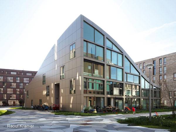
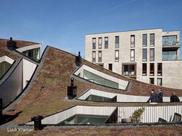
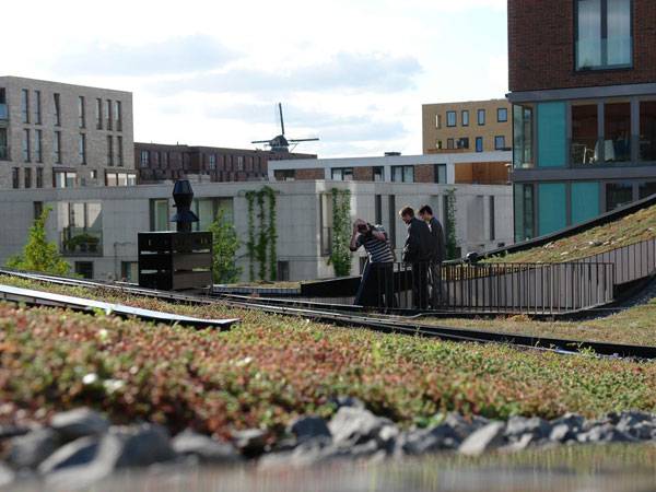
Article by Nick Shannon Funen Blok K, by NL Architects, in Amsterdam, The Netherlands. New housing developments around the world are becoming more sustainable, livable and innovative every day. The key to having a well-rounded project is in the marriage of the buildings and landscape into one continuous experience. People want to live in an area with access to and views of green space, and the field of landscape architecture is critical in designing this experience. However, we cannot do it alone. The building has to be designed with the landscape in mind, and they should both respond to one another. A great example of the blending of views and access to green space is Funen Blok K in Amsterdam by NL Architects. This article will explore why this project is successful, and how the building was designed to maximize the experience of the landscape and its relation to the community.
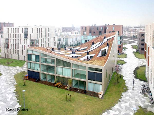
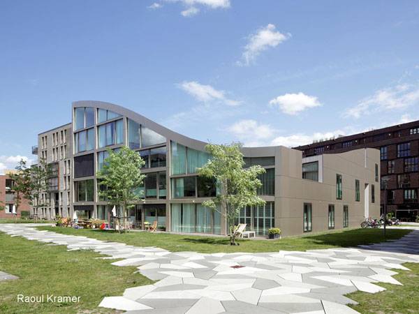
Funen Blok K. Photo credit: Raoul Kramer
Funen Blok K
Part of the Larger Funen Park Development
Funen Blok K is part of a larger housing development in Amsterdam known as Funen Park. This project sits on a former industrial site in proximity to the city centre of Amsterdam and the residential housing is part of its redevelopment. The type of housing in this neighborhood differs from the traditional Dutch residential neighborhood design of streets, parking spaces and back and front gardens. Instead, the area around the residential buildings is treated as one continuous courtyard. There are no private gardens, and the parking was put underground to allow for a purely pedestrian experience above.
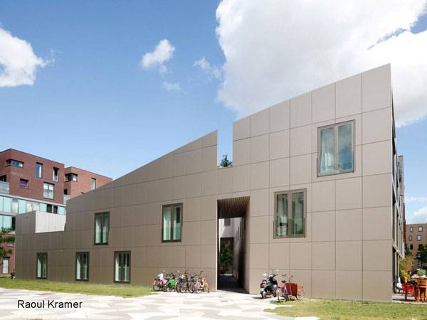
Funen Blok K. Photo credit: Raoul Kramer
Funen Blok K. Photo credit: Raoul Kramer
Funen Blok K: A New Type of Housing
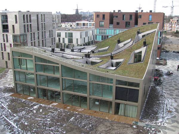
Funen Blok K is comprised of 10 housing units, all in one unified building structure that unites the residents with each other and their surroundings. Each house is 633 cubic meters in size, and the structure of each unit fluctuates, ranging from 2 to 4 stories tall and featuring rooms of varying widths and lengths. The building bay was designed to be elastic, which offers a variety of units all with the same square footage. The outside of the building is covered with bronze aluminum sheeting, which is recyclable and requires no maintenance. The material of the façade, coupled with its windows, creates a clean, straightforward design that speaks to the open, uncluttered landscape.
Funen Blok K. Photo credit: Raoul Kramer
Back-to-back Housing Style
This unique housing block is part of a larger typology of back-to-back housing, which means that traditional access is not in the front of the residence, but instead in the back.
Funen Blok K. Photo credit: Luuk Kramer
Funen Blok K. Photo courtesy of NL Architects
Funen Blok K. Photo credit: Luuk Kramer
Funen Blok K. Photo courtesy of NL Architects
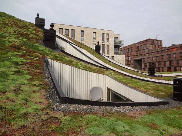
Redefining the connection between the building and landscape is a complex issue that can be expressed differently in every site. Opening up a building to the outside is a unique way to connect residents to their living environment while putting emphasis on the context of a site. Funen Blok K is a project that achieves a sense of continuity between the landscape and building, providing a seamless transition from living to recreating. We should never fall back on traditional residential design, but keep adding innovative ways of thinking about housing to create exciting and unique experiences for the user. That is what landscape architecture is all about.
- Would you want to live in this development? How do you think it could be improved? Let us know in the comments below!
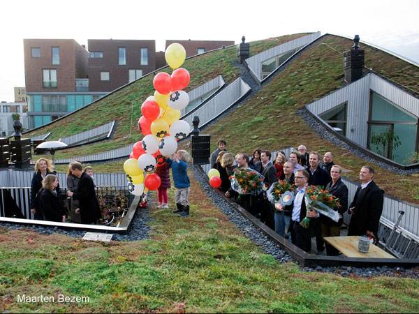
Funen Blok K. Photo credit: Maarten Bezem
Full Project Credits For Funen Blok K
Project Name: Funen Blok K Design: 1999 / 2006 Completion: 2009 Location: Amsterdam, The Netherlands Area: 1,600 m² Budget: €2,500,000 Designers: NL Architects Team: Pieter Bannenberg, Walter van Dijk, Kamiel Klaasse, Mark Linnemann Collaborators: Caro Baumann, Jennifer Petersen, Niels Petersen, Holger Schurk, Misa Shibukawa, Rolf Touzimsky Client: IBC Vastgoed / Heijmans Structural Engineers: Ingenieursbureau Zonneveld bvMechanical engineers: Sweegers en de Bruin bv Mechanical Engineers: Sweegers en de Bruin bv Building Physics: Cauberg Huygen Contractor: IBC Woningbouw Amersfoort bv Re-Design: 2006 Project Architect: Gerbrand van Oostveen Collaborators: Jung Hwa Cho, Chris Collaris, Florent le Core, Gert Jan Machiels Client: Heijmans Vastgoed bv Structural Engineers: Berkhout Tros Bouwadviseurs Mechanical Engineers: Nieman Adviesburo Contractor: Heijmans Bouw Almere Get Social with NL Architects: Website: www.nlarchitects.nl Facebook: www.facebook.com/nlarchitects Blog: www.nlarchitects.wordpress.com Recommended Reading:
- Becoming an Urban Planner: A Guide to Careers in Planning and Urban Design by Michael Bayer
- Sustainable Urbanism: Urban Design With Nature by Douglas Farrs
Article by Nick Shannon Return to Homepage

Can Rivers Provide Useful Transportation Routes in the 21st Century?
We will explore the potential opportunities for rivers to be used as a transportation route, as well as some concerns that may arise. As our population is exploding, urban areas are experiencing a dramatic increase in demand for affordable housing, transportation infrastructure, and job opportunities. As landscape architects, we have the opportunity to partake in the conversations of how to deal with this demand, and how to solve some of these problems. We will focus on the issues of transportation, a topic where we have the opportunity to design and facilitate new ways to get around cities. One exciting mode of transportation that has the potential to be used is rivers. Can they provide useful transportation routes in the 21st century?
Importance of Water
Around the world, most major cities are situated around a body of water. The importance of water as a route to move goods and people has set up cities around rivers, lakes, and the oceans. Before the construction of the ground-based infrastructure we depend on today, water was the only way to make these connections between important destinations and commerce centers.
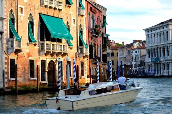
“Water-taxi, Venice, late afternoon light.” by David McSpadden. Licensed under CC BY-SA 2.0 via Flickr
Why Rivers?
Rivers are one of the most important factors that have dictated where major cities are located today. Along with the movement of goods, they can also provide a form of transportation and recreation. So many cities are situated around two or more rivers because it provides the most efficient spot to provide access to multiple places. Today, this gives us the opportunity to use rivers as a transportation route because it just makes sense.
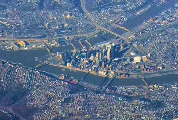
“Pittsburgh, PA.” by Ron Reiring. Licensed under CC BY-SA 2.0 via Flickr
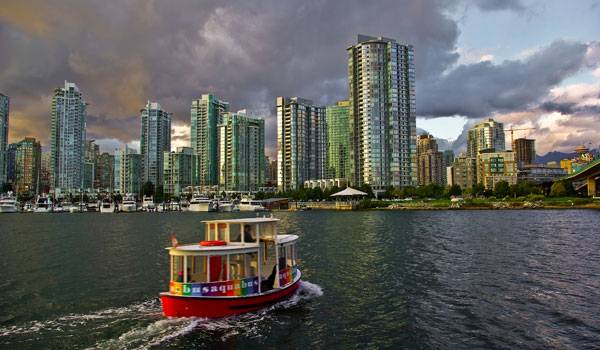
“The aquabus making its rounds Capturing some amazing evening light on the seafront trail – one of a few I thought worked out really well. Love those aquabus colors against the skyline.” by David J Laporte. Licensed under CC BY-SA 2.0 via Flickr
Types of Transport
There are a lot of ways to use rivers near a city. One of the most widely used options are ferries, but they only move people between two destinations, which isn’t the most feasible for mass public transport. A water bus or water taxi is the type of river transportation that makes the most sense for public transit. They can have multiple stops along the river and are ideal for commuters to get across the river or move up/down based on their needs. A loop route can provide access to multiple popular destinations.
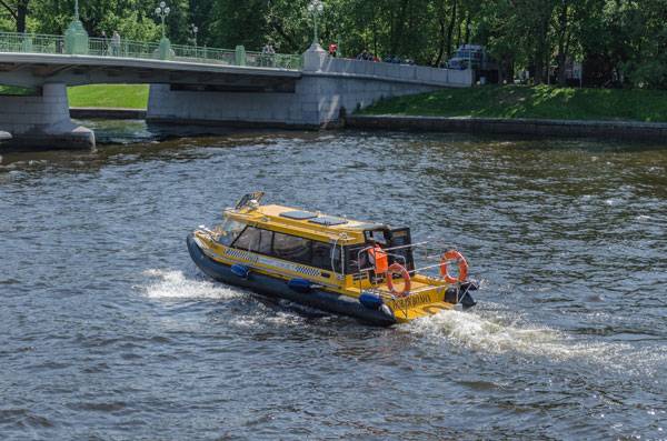
“Aquabus in Saint Petersburg” by Alex Florstein. Licensed under CC BY-SA 3.0 via Wikimedia Commons
Cities That Are Doing It
Using rivers as a transportation route isn’t a new idea, it just isn’t widely used yet. There are a lot of cities that use rivers for transportation. St. Petersburg is a city that has started adopting river transportation. Along with river cruises or sightseeing trips, the Neva River is also used by the Aquabus, which is used by commuters to get to specific points along the river. It is used in their daily routes to work and back. It is also the cheapest form of water transportation in the city. Chicago is also utilizing their river with the Chicago Water Taxi. A closed loop route on the Chicago River shuttles thousands of commuters between five major stops every day. This unique public transportation gives commuters a vastly different experience than a train or bus on the ground. There are also water taxis in the Washington DC area that bring people between the National Mall, Alexandria, VA and National Harbor, MD along the Potomac River. It is easy to get a boat across and up or down a river to major cities such as this, especially when they are in such close proximity. Having multiple transportation options is always a good way to decrease congestion. These are just a few examples of cities that are using river transportation.
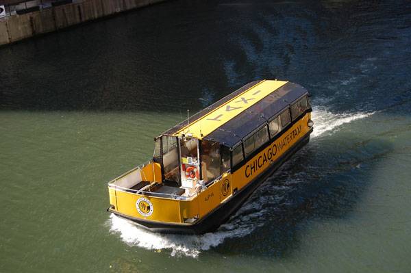
“Chicago Water Taxi” by Luke Gordon – originally posted to Flickr as Chicago 29 Oct017. Licensed under CC BY 2.0 via Wikimedia Commons
Concerns
River transportation does bring up some concerns. Because it is not widely developed, the fare prices will probably be high in the beginning. In the United States, water-based transportation is not subsidized by the government like trains and buses are, which can increase the fare price as well. Boats are also not the most environmentally friendly option because they use a high amount of diesel fuel per mile. However, with the demand for an increase in public transportation, it is more economical than constructing new ground-based transportation routes. A river transportation system needs to have multiple stops with developed points to bring people to and from the city. How do we do this? A lot of business districts in cities are not directly near a river or body of water, so this raises some concern. Determining these points is key in starting to explore this route of transportation. A route that loops between major destinations is the most feasible, with multiple boats to carry passengers. However, how do you find the most efficient route that will sustain a population of commuters? Water accessibility has become a hot topic in landscape architecture that can be built upon with river transportation. We are trying to provide increased access to rivers and waterfronts through esplanade projects and parks to revitalize waterfronts, but can we add another layer to it and create stops for river transportation?
How Can We Adapt?
It is hard to adapt to a new paradigm of transportation. Using rivers can be extremely beneficial to cities and commuters, but it will take a while to change our current mindset and open up to the idea. Change doesn’t happen overnight. We can see a few cities testing out the idea, but they are mostly private companies that have small-scale operations. Is it possible to do this on a larger scale? With funding concerns, it is easy to say that using rivers will be more cost-effective because you don’t have to build high-capital projects like roads, tunnels or bridges. You just take advantage of the natural resource of a river, buy the boats and develop terminals and stops. It is definitely possible; we just have to bring this topic into the conversation of planning and new development for cities. Do you think river transportation can become the next form of mass public transport? Would you use a river for your daily commute? Recommended Reading
- Landscape Architecture: An Introduction by Robert Holden
- Landscape Architecture, Fifth Edition: A Manual of Environmental Planning and Design by Barry Starke
Article by Nick Shannon

10 Reasons Why You Still Suck at Drawing
We will explore some of the reasons why you think you suck at hand drawing and how to change that. Landscape architecture requires a broad set of skills to understand a site and to propose a design. Among the most important of these skills is hand drawing. Being able to sketch an idea or a landscape gives you the ability to understand it at a deeper level in a relatively quick time. It is also one of the best ways to have a conversation with a client. Learning how to draw isn’t as hard as it seems, and now is the best time to learn. We all want to be good at hand drawing, but what are the things that block us from doing so?
10. You Don’t Think You Can
More than often, our minds are our biggest roadblock and we don’t even realize it. Drawing is all about attitude and confidence. If you think you can draw, you will be able to. If you don’t think you can draw, you won’t even give yourself the chance to try. So, even if you think you might be bad, believe you can do it … because you can!
There’s certainly no lack of confidence here – One of the participants in our Sketchy Saturday feature. By Lily Mank
9. You Care What Other People Think
When we see somebody else’s drawings, we sometimes wish we had their talent or ability to draw. Too many people say that they suck at drawing, and hearing it so often tricks our own mind into believing we suck, as well. However, it doesn’t matter who is better than you. We all have a different style, and you just need to find what works for you. So, stop caring what people say about your ability or talent and just draw.
8. You Are Not Seeing The Subject
To be good at drawing, you have to look at the world with a new perspective. Don’t label objects in your mind and just draw the shapes you see. This is the true essence of drawing: You don’t need to label the subject with words, just look at it with fresh eyes and draw what you think, not what you think you see.
WATCH: Linescapes: Drawing Landscape Architecture – Introduction video
7. You Don’t Do It Enough
Nobody is good at drawing out of the gate. You have to practice every day. Carry a sketchbook around wherever you go so you’re ready whenever inspiration strikes. Actively seek out inspiration and draw it. Draw your ideas and use your sketchbook to refine them into something better. Take the time to sketch, and you will improve. It doesn’t matter if you are just scribbling or drawing details; just get out there and draw real things. Become an addictive sketcher and fill up your sketchbook.
WATCH: Adebanji Alade’s Sketch Inspiration Hot Shot 6
6. You Won’t Try Different Techniques
It is easy to get stuck in a mood where you think that anything you draw is bad. However, you have to have an open mind and try new things. There are so many different ways you can draw — with pencils, pens, charcoal, etc. Alternate between drawing mediums when you are stuck. Doing this will help you experience the landscape in a different way. Be bold with charcoal and play with positive/negative aspects of light and spatial patterns, or be delicate with a pencil. Draw with a pen or markers for a totally different outcome.
WATCH: Vic Bearcroft Charcoal Landscape
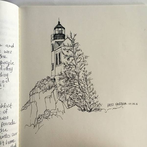
WATCH: Linescapes: Drawing cliffs, pen and watercolors
5. You Are Tackling Too Much
Don’t try to create a massive drawing at first. Begin with a small sketchbook and work your way up. This will help with your composition and make it easier to move on from a bad drawing. It makes it easier to try different scenes and techniques if you are drawing on a smaller sketchbook. If you fill up a small sketchbook, you will feel accomplished and get the feeling that you can do it! Make a goal to finish a sketchbook by a certain date to force yourself to sketch. Then tell somebody else about it so you actually do it!
Start up your own sketchbook. Photo credit: Nick Shannon
4. You Use an Eraser Too Much
When sketching with a pencil, it is easy to get dragged down by erasing one line over and over. There is no point in laboring over every detail; it just wastes time that could be spent drawing more. If you draw with confidence, your lines will be smoother and it will look better in the end. Be bold and draw the essence of your subject or idea. That is what drawing is all about anyway. The best way to force yourself to be confident is to use a pen or ditch the eraser. If you can’t erase, you will have more confident lines and be less afraid of making a mistake. If you don’t have to draw to scale, let go of the urge to be perfect and just go for it.
3. You Think Too Much
Drawing requires your full concentration. You have to get in the right mindset and clear your space of any distractions. When you are in the zone, you lose sense of time and don’t think of language. If you have never experienced this feeling, you have never truly drawn anything. You have to be in the moment completely and devote your concentration to the task at hand. Language often gets in the way, and our thoughts cloud our minds with mundane chatter that distracts us from drawing. Draw mindfully and don’t let your brain wander to other subjects.
2. You’re Not Using The Right Side of Your Brain
When you are in the middle of drawing and in the zone, you are using the right side of your brain. This is the creative side of your brain, unlike the left side, which is all about logic. Drawing is the perfect opportunity to facilitate the shift from left to right brain function. This is when you lose sense of time and language to become fully immersed in the process of seeing and drawing. If you want to learn more about the right and left brain, pick up a copy of Drawing on the Right Side of the Brain by Betty Edwards. This upside-down drawing of a sketch by Picasso tricks your brain into using the right side because you just look at the lines, not at what you think a person looks like.
WATCH: Drawing on the Right Side of the Brain: my upside down Picasso sketch of Stravinsky
1. You’re Not Having Fun!
Probably the most important thing to remember is that drawing is fun! You should do it because you love it. The feeling of satisfaction after you draw something well is unlike anything else, so practice until you reach that point! It will get easier with time; just be patient with yourself and don’t fret over the little stuff. Draw landscapes to understand them, bring that knowledge back to the office, then draw your design ideas. – Drawing is not a natural talent that you either have or you don’t. With enough practice and dedication, you too can become good at drawing. It will help you better communicate with clients, and you will see the world in a different way. Once you understand the basics of hand drawing, the same practices can transition into your digital work, which will be better as a result. Now go pick up your sketchbook and draw something! What is the roadblock that is making you think you suck at drawing? Recommended Reading:
- Drawing and Designing with Confidence: A Step-by-Step Guide by Mike W. Lin
- Landscape Perspective Drawing by Nicholas T. Dines
Article by Nick Shannon Return to Homepage Featured image: Printscreen from Linescapes: Drawing cliffs, pen and watercolors

Are Renderings Bad for Landscape Architecture?
Are renderings all they are cracked up to be or do they just cover the cracks? We explore renderings and the different mediums used to help us draw our conclusion. The field of landscape architecture uses a diverse mix of tools to create, design, and communicate ideas. We solve problems through design and make spaces better for the people who inhabit them. The design and construction of a project is made possible through the help of computer software and hand drawing or drafting. Photoshop perspectives, plans and sections, 3-D models, and hand drawings all help communicate a design to the public, the client, or the contractor. However, this does bring up an interesting issue: Are renderings true to the design and its construction? We make pretty pictures, but are some of them doing more harm than good?
Types of Renderings
We need renderings in landscape architecture to communicate design ideas to our clients, our peers, and contractors. Renderings are often used to sell a project in a way that idealizes the landscape to create a “perfect” image. It is not always an idealization, but a visualization. The artistic leeway we use in renderings is necessary, because no one can completely predict what a landscape will look like after installation. That means renderings have the potential to create some unrealistic expectations.
More Top Articles on LAN
- 10 of the Most Common Mistakes People Make in Planting Design and How to Avoid Them
- Interested But Not Confident? – Know How to be Good at Hand Drawings
- Top 10 YouTube Tutorials for Technical Drawing
Let’s explore the different types of renderings and their uses
Photoshop Perspective
A well-done perspective can give the viewer a feeling of the experience he may have in the landscape represented. This is the image people will gravitate toward when looking at final boards, because it is the most enticing and seductive. As a result, people often put a lot of effort into Photoshop perspectives to sell a design, win a competition, or communicate an idea. You get a feeling for the experience of the landscape when you see people doing things in the perspective or when vegetation and lighting are used to create a distinct atmosphere. These techniques help to convince the viewer that this landscape will work and show him that people will want to use it. WATCH: Here is a great example of a perspective and how far you can go to alter an image:
Perspective Rendering for Landscape Architecture: Photoshop Workflow
Plans and Sections
Plans and sections are versatile drawings that can be used to communicate to the client and the contractor. We can all picture an AutoCAD planting plan, section detail, or rendered section because they are so widely taught and used. On the plus side, these renderings can be drawn to scale, which proves to be essential during construction. They are a more concrete way to say what is going to be built, because plan view is not the easiest thing to render. Therefore, trees are often stylized to represent canopy cover and not what the final planting will truly look like. We need these renderings to get things built.
J R Mercer Slough, masterplan. Credit: Jone and Jones
3-D Models
Modern computer software is so advanced that we can now create a project in virtual reality. The potential to experience the landscape through a video or screenshots or to “walk” through it on the computer is really exciting to clients and designers. It’s also fun! Programs such as SketchUp, Rhino, and 3ds Max can idealize landscape characteristics to create an environment that may not look anything like the real world. However, it does give you a visual of what the landscape might roughly look like.
3D Rendering Images of Public Small Space at Mataram City, Lombok Island Indonesia. Image credits: Khatibul Umam bin Ahmad Fauzi, 3D Visualizer
Realtime Landscape Architect rendering
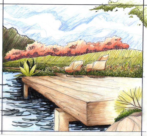
Hand Drawn
The most rustic of the bunch, hand drawings evoke a physical sense of the landscape. The hand of the designer is easily seen and used to show the possibilities. Hand drawing forces an understanding of the spatial characteristics of a space. You need to know how to hand draw to be good at computer software. Computers don’t think – we do — and we need to be designing while drawing. And hand drawing is the best place to start. Drawing in front of a client is the most engaging thing you can do to spark a conversation and come up with a better solution. WATCH:Hand-drawing a plan
Fast Sketch – Landscape Design
WATCH: Sketch in the field to build up your knowledge of how other sites work
Linescapes: Drawing Landscape Architecture – Introduction video
Controversy
I think we can all agree that renderings are not perfect. There is no way to know what a landscape will really look like. This has forced us to make assumptions and predictions, with a broad understanding of natural processes and environmental relationships. It’s not a bad thing, just a fact of the profession. We just need to understand that things will change, and a resilient design will adapt to potential change in a positive way. Renderings are not what the final product will look like. Designs change in response to climate, construction implementation, budget concerns, and the growth patterns of plants. They are used to show an idea of the potential of the site, not what it will become. This is often enough to get a client interested in pursuing a project. The perfect image is not what will be built, but it does increase the understanding of what it can be.
More Top Articles on LAN
- 10 of the Most Common Mistakes People Make in Planting Design and How to Avoid Them
- Interested But Not Confident? – Know How to be Good at Hand Drawings
- Top 10 YouTube Tutorials for Technical Drawing
Most of the time, renderings show landscapes that work, which is not always the case. We tend to put a lot of happy people in our drawings, but we never know how people will react or if they will even use the space. Our eyes naturally register a photograph as the true representation of an existing condition. When we manipulate photographs into what we want our design to look like, it tricks our minds into believing something is real. This is highly persuasive, but the reality of it needs to be understood.
So, what should we do?
There is no perfect answer to the applicability of renderings in landscape architecture. Every firm and person will do it differently, creating a diverse and exciting mix of possibilities in the field. However, the one lesson that should be taken away is that drawings should be used to explore relationships and study ideas. If you are not designing when you are rendering, something is wrong. Have knowledge beyond the rendering to understand the spatial and natural relationships of the landscape. Layering information based upon experience will make you more credible and successful in the field. Create a feedback loop, in which you go out and see what you know works and bring that knowledge back to the office to layer into the drawing. WATCH: An architect’s design process (we should be thinking in a similar way at the start of each project):
How To Think Like An Architect: The Design Process
Real-world design needs to respond to people, scale, and context. Always be cognizant of the experience of a site while designing, and use your broad knowledge base to create relationships that have the potential to really work. Have an open mind, and create thorough drawings that explore and study creative alternatives. How do you use landscape architecture renderings in your daily practice, and how should we use them in a way that is true to both the client and the designer?
Recommended Reading
- Landscape Architecture: An Introduction by Robert Holden
- Landscape Architecture, Fifth Edition: A Manual of Environmental Planning and Design by Barry Starke
Article by Nick Shannon Return to Homepage


10 Tips to Help You Be a Top Landscape Architecture Student
A run through of 10 ways to be a top Landscape Architecture student. College is a hard time when you have to focus amongst many distractions. Everyone wants to do well and make his or her time in university worth it. But most of us are so busy either procrastinating or neck deep in our work that we forget to stop, breath, look around and see that there may be a better way of doing things. Ways to make us more efficient at getting things done and achieving better results. While some of these tips may be obvious to some of you, we can all use a little reminder from time to time, and ultimately the real question is, why aren’t you doing them?
Top Landscape Architecture Student
Here are 10 top tips to help you get there:

Never underestimate the value of being an active participant in the classroom. Photo credit: shutterstock.com
7. Don’t Be Afraid Push the boundaries of what you are assigned to do. Take risks and don’t be afraid. This is the only way you can achieve greatness and not get stuck in what everyone else is expecting you to do. The studio can be overwhelming, but push past your preconceptions and motivate yourself to take on the challenge. Don’t be afraid of failure — nobody is born a great designer. Allow yourself to be a beginner and make mistakes, and you will be rewarded. Related Articles:
- 5 Cities a Landscape Architecture Student Should Visit and Why
- 10 Mistakes Every Landscape Architecture Student Makes and How to Avoid Them
- 7 Things You Should Never do as a Landscape Architecture Student!
6. Connect with People Your education should go beyond your classes. Talk and connect with your professors and classmates to get the most out of this experience. Take the time to ask them about your interests, and they most likely will help you. These connections will become the people you go to when you are stuck, looking for advice, or seeking job references. Find that person (or people) that you can turn to, and allow them into your life. 5. Get Your Hands Dirty Hands-on learning is very rewarding. The rigor and flexibility of studio gives you a great opportunity to work hands-on, in a way that students in a lot of other majors can’t. Go on-site visits as often as you can! Find innovative ways to do field work that will push your design to the next level. Analysis of your site will focus your design and make it that much more applicable. This is a great skill to have because it is what happens in the real world. We work on real sites and have to respond to their existing conditions, so cultivate your ability to do this now! 4. Get Involved in Something — Anything Don’t waste the free time you have; use it to lift yourself to the next level of learning and experience. The field of landscape architecture is broad, and you need to put yourself out there to find where your interests lie. Volunteer in your community, visit firms, or talk to people in your college. Find internships that excite you and apply to all of them. These experiences will help you decide your future career path, and that is why we are in school, isn’t it?
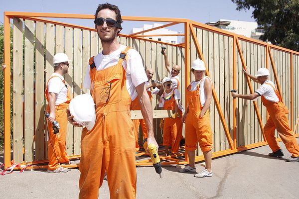
72 Hours Urban Action is an international rapid architecture event. Photo credit: Mor Arkadir
Recommended Reading:
- Landscape Architecture: An Introduction by Robert Holden
- Landscape Architecture, Fifth Edition: A Manual of Environmental Planning and Design by Barry Starke

Queens Botanical Garden Leads us Into a Future of Sustainability
Queens Botanical Garden, by Atelier Dreiseitl and Conservation Design Forum, in Flushing, New York, USA. The field of landscape architecture puts a lot of focus on urban areas. The dense stratification of people and buildings screams for a new perspective that can breathe life into the built environment and offer a different experience. Queens, New York, is a dense urban environment that has a unique public space that gives the community a nature-based experience. The Queens Botanical Garden has served as a cultural and educational connection for the diverse population of Queens and provided a space for people to interact with nature and each other. The Queens Botanical Garden Master Plan, developed by Atelier Dreiseitl and Conservation Design Forum, is being used to encourage sustainability and cultural expression through design framework that will guide future decisions affecting the garden.

Queens Botanical Garden Photo courtest of Atelier Dreiseitl
Queens Botanical Garden
Queens Botanical Garden began as a horticultural exhibit at the 1939 World’s Fair and was expanded for the 1964 World’s Fair. Initial master planning efforts began to think of a use for the space after the fair, but a plan was not implemented until 1997, when Phase 1 of the Queens Botanical Garden Master Plan was started by the landscape architectural team of Susan Wisniewski and Jamie Crelly Purinton. Their vision for the 39-acre site drew upon the surrounding community to create a design framework that would be flexible with change. Phase 2 of the Master Plan was completed in 2002, led by Atelier Dreiseitl and Conservation Design Forum. This phase is being used to guide the complete renovation and expansion of the garden in the future.

New York Queens Botanical Garden. Photo credit: ESTO
- How The Chicago City Hall Green Roof is Greening the Concrete Jungle
- Potsdamer Platz in Berlin Becomes a Sustainable Ecofriendly Urban Square
- How Bishan Park Became “The Central Park” of Singapore

New York Queens Botanical Garden. Photo credit: ESTO

New York Queens Botanical Garden. Photo credit: ESTO

New York Queens Botanical Garden. Photo credit: ESTO

New York Queens Botanical Garden. Photo credit: ESTO

New York Queens Botanical Garden. Photo credit: ESTO

New York Queens Botanical Garden. Photo credit: ESTO
Recommended Reading:
- Landscape Architecture: An Introduction by Robert Holden
- Landscape Architecture, Fifth Edition: A Manual of Environmental Planning and Design by Barry Starke
Article by Nick Shannon
- 1
- 2