Article by Farah Afza Jurekh – Total reading time 4 minutes. Sugar House S-Line Streetcar and Greenway, by CRSA, in Salt Lake City, Utah, United States. Designing has never been an easy job. Architects put their creative ideas to work to bring out the best from a space. But this just cannot be the representation of their thoughts only. A design can only be successful when it is not a whimsical depiction of architects’ ideas, imposed on users. That is why, before jumping into the design phase, it is important to do extensive studies, research and analyses. Architects can’t impose their decisions on people, the users, and the community. People will never accept any design which does not respect the site context, its background, microclimatic conditions, historical importance of the site and its context, the behavioral pattern of the neighborhood people, the land use pattern of the neighborhood and the users’ opinions regarding the transformation of that site.
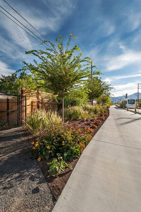
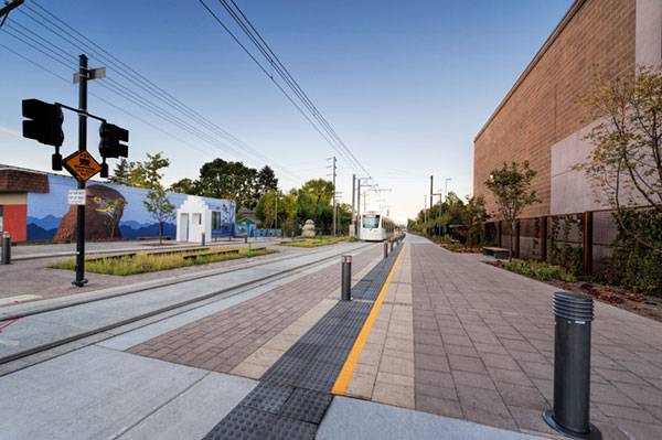
Sugar House S-Line Streetcar and Greenway. Photo credit: Robert Holman
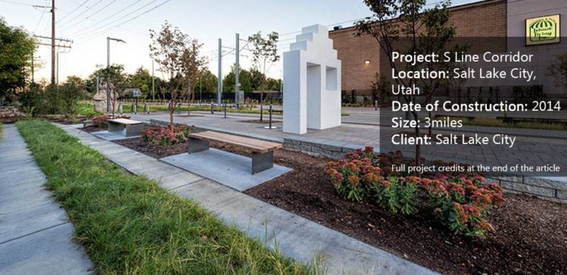
Sugar House S-Line Streetcar and Greenway
Well, S line corridor is an excellent example of one such project designed by CRSA, in Salt Lake City, Utah, which has transformed an abandoned rail corridor into a greenway through rigorous research and analysis on the corridor and the community living around the site to retain its sense of place. As a result, the master plan is the result of a synthesis of ideas generated by the community and the design team. WATCH >>> Streetcar Greenway: The Complete Tour
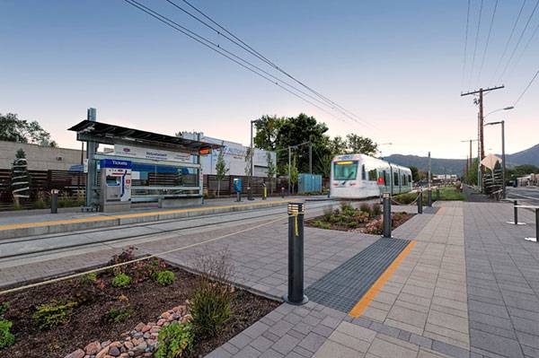
Objectives and Vision of the Master Plan The main vision was ‘to connect people to places’ via multiple modes. The objective of the master plan was to design an area which offers a destination to the users, utilizing nature, play, connections and art to make that destination special. The S Line Corridor functions as an urban thoroughfare and public open space, helping people make connections, reducing barriers, promoting healthy lifestyles, and protecting and creating built, natural, social, and cultural resources.
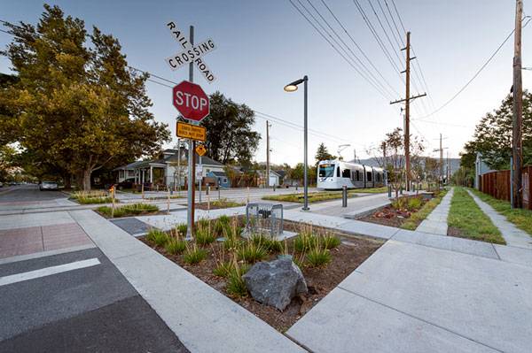
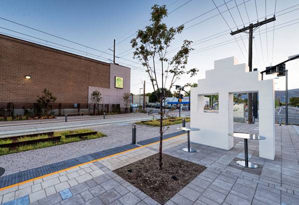
Sugar House S-Line Streetcar and Greenway. Photo credit: Robert Holman
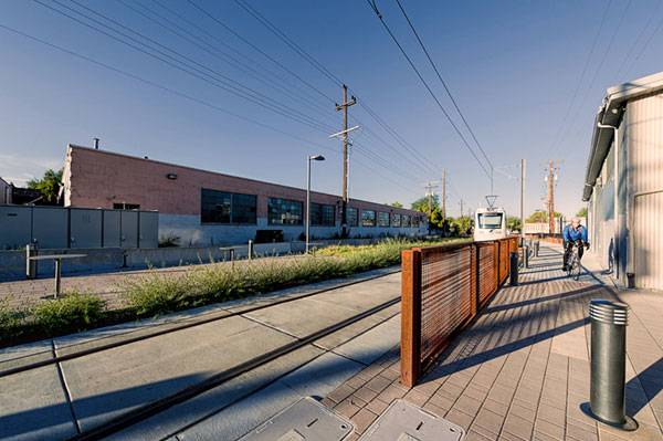
Since the 3-mile S Line Corridor passes through neighborhoods of different land uses, varying from commercial, industrial, to residential zones, the design team needed to segregate each zone because of the diversities in cultural, physical, and social aspects. Starting from the Canyons and ending at the Great Salt Lake, each block has a specific landscape theme and these are represented as alpine, mountain brush, narrow canyon, river bend, foothill, and valley.
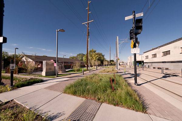
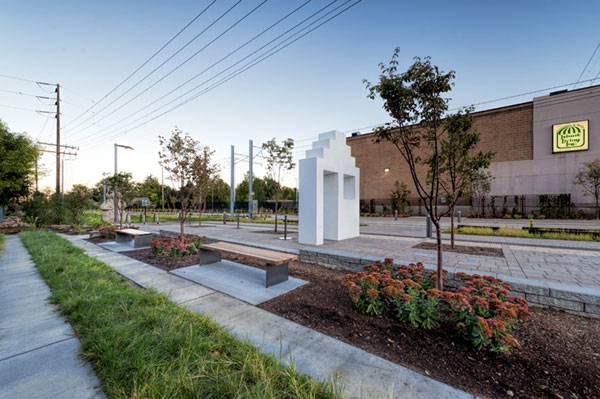
Sugar House S-Line Streetcar and Greenway. Photo credit: Robert Holman
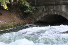
Alpine Corridor Running from east to west, this section of the corridor was designed to reflect water falling from the valley. The granite boulders put down by artists contribute to the visual characteristics of the Canyons. The European aspen (Populus tremula) was chosen over the native aspen (Populus tremuloides) as it can withstand warmer temperatures. At a higher level, a meadow-like space is formed with different species of grasses to mimic the picturesque views of the valley and the mountainside. The history of the corridor has been predominantly rail.
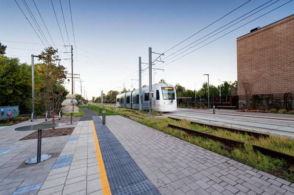
Sugar House S-Line Streetcar and Greenway. Photo credit: Robert Holman
Reflection of History In order to reflect the history of this place and to attach people emotionally to it, a sculpture, using rails, was constructed and the names of the companies associated with South Salt Lake and Sugarhouse were inscribed in the nearby concrete pavers.
Sugar House S-Line Streetcar and Greenway. Photo credit: Robert Holman
Sugar House S-Line Streetcar and Greenway. Photo credit: Robert Holman
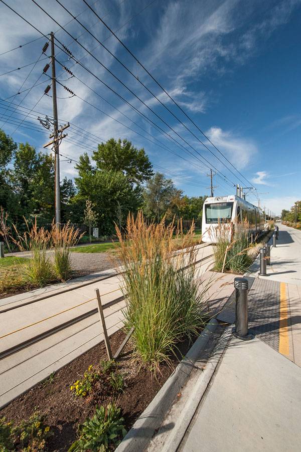
Rain Gardens and the Control of Storm Water As the corridor descends, the central portion is designed with gravels and boulders to form rain gardens. Rain gardens collect rainwater hitting the hard surfaces and control storm water runoff. Through infiltration, the grey water is treated organically, improving its quality before it re-enters the ecosystem. Mountain Brush This section is bejeweled with the use of different native species like Sedum telephium ‘AutumnJoy’. The plants, when in full bloom, attract pollinators and can give an outstanding view to the public. Meanwhile, paperbark maple (Acer griseum) was also planted, with the intent to provide shade to users. The species which are adaptive to this microclimate are chosen meticulously. Apart from that, metal trellises with climbers are used along the edge in order to add even more green to this zone.
Sugar House S-Line Streetcar and Greenway. Photo credit: Robert Holman
Sugar House S-Line Streetcar and Greenway. Photo credit: Robert Holman
Trails and Rails The rain gardens are further adorned with rails to contribute to the existence of rail lines along that trail. As the trail expands, two lanes are separated with the use of different types of grasses. The second lane is designed with trimmed turf grasses while the others feature longer grasses. The second lane is designed to hold different playful and leisurely activities of the community. Interactive artworks are placed at each section of the landscaped zones since they will encourage more people to transform the corridor into public place.
Sugar House S-Line Streetcar and Greenway. Photo credit: Robert Holman
Sustainable Green Eco Tones As the name suggests, throughout the whole design process, the term ‘green’ was implemented successfully. The choice of native species over other species to attract native inhabitants and the design of the rain garden for rainwater harvesting are the approaches which make the project sustainable.
Sugar House S-Line Streetcar and Greenway. Photo credit: Robert Holman
Equity Another success of the design team is their programming of the trail and its nodes to allow use by a wider range of user groups – intergenerational stakeholders who will use multiple non-motorized modes and multiple speeds within those modes. Whether it is a person strolling through to enjoy the landscaping and nature or a commuter in the way to their job, the trail will recognize and embrace this diversity. Universal accessibility was not overlooked, either; tactile surfaces with curbs are also provided to ensure the safety of the physically challenged users. Overall, the line corridor once again teaches us the importance of respecting the historical background of the site, highlighting the physical, social and cultural features of the area, and listening to the opinions of the end users, for landscape architects. The achievement of CRSA through this project is surely laudable and praiseworthy. Go to comments
Sugar House S-Line Streetcar and Greenway. Photo credit: Robert Holman
Full Project Credits For the Sugar House S-Line Streetcar and Greenway:
Project Name: Sugar House S-Line Streetcar and Greenway Location: Salt Lake City, Utah Designers: CRSA Date of Construction: 2014 Length: 3 miles long Client: Salt Lake City Photo Credits: Robert Holman Recommended Reading:
If this is your first time on the new site, please click "Forgot your password?". Follow the steps to reset your password. It may be the same as your old one.