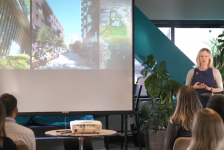
Scott Carman is an assistant professor of landscape architecture and urban design at Colorado State University. He joined the Land8x8 Lightning Talks to speak about his recent research and advocacy project, the Colorado Brightfields Initiative. The research project began in 2018 after Governor Jared Polis, aimed to set the state of Colorado on a path to 100% renewable energy generation by 2040.
The term “brightfield” was coined in 2012 by the EPA to describe contaminated or disturbed sites, such as brownfields, with the potential to be converted for renewable energy generation. One example can be seen as photovoltaic panels harvest solar energy over the former Hickory Ridge Landfill in Conley, Georgia.
Because of the large land areas needed for renewable energy farms, land use challenges arise. “While renewable energy is going to be key to helping us kick our addiction to fossil fuels, it is a land hog and takes 10 times the land area to produce the same unit of energy as fossil fuel.” Carman is hopeful that brightfields can become opportunities to utilize land that would otherwise remain undeveloped.
To ensure that the research team provided data applicable to a wide range of users, a project advisory committee was formed from the beginning. The committee consisted of federal and state agencies, energy developers, community members, conservationists, and utility company representatives.
The Colorado Brightfields Initiative utilizes multiple types of data to map and analyze brightfields across the state, providing a best practice tool for the siting and future development of renewable energy farms. The initiative uniquely features a parcel-based (polygonal features vs. point-based features) approach to help stakeholders better understand the land area and characteristics of each potential site.
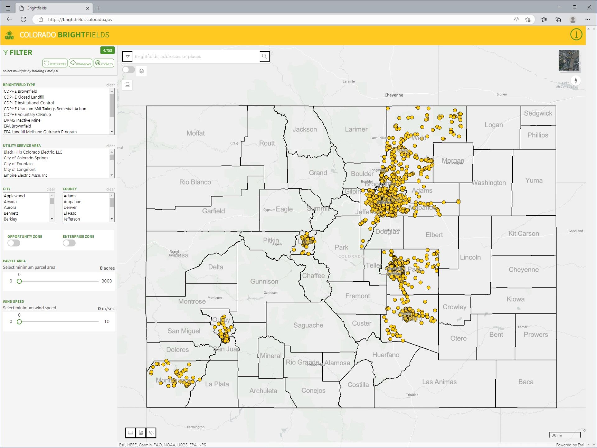
While a precedent for this type of tool exists (i.e. EPA’s Re-Powering Mapper), the EPA and other state tools only utilize point-based data. The Initiative expands upon these precedents to do both. It locates places on the map, while also providing critical information regarding the site’s character and harvest potential. Data, such as regulatory and legal information, is provided in addition to information about the physical environment, such as tree canopy coverage. Mapped areas include overlays with additional layers of helpful data (i.e. renewable energy substations, FEMA flood hazard zones, and conservation land parcels).
“Being a landscape architect, it seemed obvious to me to include parcel information. We needed to understand more about the configuration of land. This is something not as obvious to people who deal with renewable energy,” Carmen adds.
The initial study, funded by the Colorado Evaluation and Action Lab, allowed the team to pilot the project for ten counties across the state. Innovative tools like the Colorado Brightfields Initiative showcase how multi-disciplinary research initiatives can aid in positioning states as leaders in clean energy economies. Additionally, it showcases the potential for landscape architects to utilize creative problem-solving skills outside the scope of traditional practice.
—
This video was filmed on January 19, 2023 as part of the Land8x8 Lightning Talks sponsored by Anova Furnishings.


Published in Blog, Cover Story, Featured
![The Next Green Revolution [Video]](https://land8.com/wp-content/uploads/2018/01/Thomas-Rainer-Land8x8-224x150.png)